Azdavay
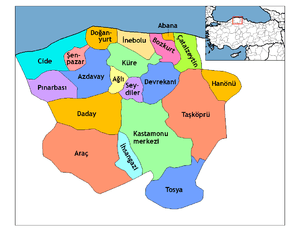
Azdavay, also Çarşamba, is a town and district of the Kastamonu Province in the Black Sea region of Turkey. It is located about 74 km away to the northwest of the province center Kastamonu. It is bounded by Cide to the north, Daday to the south, Pınarbaşı to the west, Küre to the east and İnebolu to the northeast.
Azdavay | |
|---|---|
District | |
 Location of Azdavay within Turkey. | |
 Azdavay Location of Azdavay | |
| Coordinates: 41°39′N 33°18′E | |
| Country | |
| Region | Black Sea |
| Province | Kastamonu |
| Government | |
| • Mayor | Osman Nuri Civelek (AKP) |
| Area | |
| • District | 772.03 km2 (298.08 sq mi) |
| Elevation | 928 m (3,045 ft) |
| Population (2012)[2] | |
| • Urban | 2,757 |
| • District | 7,272 |
| • District density | 9.4/km2 (24/sq mi) |
| Time zone | UTC+2 (EET) |
| • Summer (DST) | UTC+3 (EEST) |
| Postal code | 37xxx |
| Area code(s) | 366 |
| Licence plate | 37 |
| Climate | Cfb |
| Website | azdavay.com www.azdavay.bel.tr |
History
Archaeological findings hint that history of Azdavay reaches back to the Paphlagonians in 8th century BC. The region was dominated by the Hittites, Lydians, Persians, Hellenes, Pontus, Bithynians, Romans and the Byzantines in conjunction with the general historical timeline of the Kastamonu province. During the reign of the Jandarids, it was one of the 36 districts subject to the Kastamonu Sanjak. With the conquest of the region by the Ottoman sultan Mehmed II in 1460, Azdavay was annexed to the Ottoman Empire. In 1868, when the neighboring Daday was made a district of Kastamonu, Azdavay was attached to Daday as a town. After the proclamation of the Turkish republic, Azdavay was made a district in 1946, although by the secession of the towns Ağlı and Pınarbaşı in 1988, its population and land area largely decreased.
Geography
Azdavay is in the western Black Sea region of Turkey, in the northwest part of the Kastamonu province. Its land area is 772 km2 (298 sq mi),[3] the territory is mostly mountainous and covered with fertile forest areas. Its average elevation is 830 m, with the highest peaks reaching 1,300 m. Important streams are Devrekani entering the Black Sea, Valay and Gümürtler.
cultural structure
Çatak Kanyon (Chatak Canyon), medil cave, lovers bridge, waterfall palace are most popular Places and natural beauties in Azdavay district.
Climate
Due to the mountain range surrounding the district to the north, the Black Sea climate does not primarily dominate. The winters are quite harsh, and the summers are fairly hot, while precipitation starts to fall in autumn until April, often as snow. Temperatures might drop as low as -35 °C during winter, and rise as high as 40 °C in summer. Also day and night temperatures might differ greatly, which negatively affects agriculture (fruits and vegetables).
Economy
Mining industry, ready-made textile manufacturing, forestry, livestock and some agriculture. Although there are some greenhouses, it does not have significant effect on overall economy.
Highlights
The most noteworthy locations in the district are the natural sites which include a 4 km long canyon on the Devrekani stream and the Medil Cavern in Karakuşlu. Some remains which have been identified as Roman have also been found. One of the customs specific to the district is the traditional wedding ceremony called "three-day", which is also worth observing.
Demographics
According to the 2010 census, population of the district is 7,559 of which 2,739 live in the town of Azdavay.[4] Due to the low level economic activity in the district, migration to bigger provinces such as Istanbul is prevalent, resulting in population decrease. In consequence, some rural areas are completely deserted, and some schools closed.
Notes
- "Area of regions (including lakes), km²". Regional Statistics Database. Turkish Statistical Institute. 2002. Retrieved 2013-03-05.
- "Population of province/district centers and towns/villages by districts - 2012". Address Based Population Registration System (ABPRS) Database. Turkish Statistical Institute. Retrieved 2013-02-27.
- Statoids. "Statistical information on districts of Turkey". Retrieved 2008-11-23.
- Turkish Statistical Institute. "Census 2000, Key statistics for urban areas of Turkey" (in Turkish). Archived from the original (XLS) on 2007-09-27. Retrieved 2008-11-14.
References
- Falling Rain Genomics, Inc. "Geographical information on Azdavay, Turkey". Retrieved 2008-11-14.
External links
- District governor's official website (in Turkish)
- A web site on Azdavay (in Turkish)
Azdavay in Kastamonu Province of Turkey | |||||||||||||||||||||||||||
|---|---|---|---|---|---|---|---|---|---|---|---|---|---|---|---|---|---|---|---|---|---|---|---|---|---|---|---|
| Districts | Districts of Kastamonu | ||||||||||||||||||||||||||
| |||||||||||||||||||||||||||
Metropolitan municipalities are bolded. | |||||||||||||||||||||||||||