34th parallel north

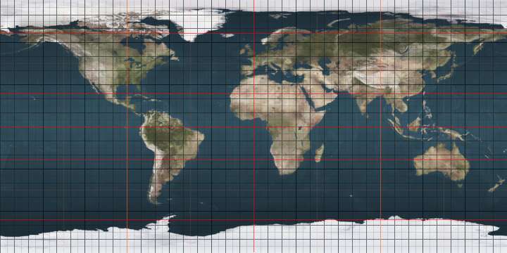
The 34th parallel north is a circle of latitude that is 34 degrees north of the Earth's equatorial plane. It crosses Africa, the Mediterranean Sea, Asia, the Pacific Ocean, North America and the Atlantic Ocean.

34°
34th parallel north

The parallel formed the southern boundary of the original Colony of Virginia as outlined in the London Company charter.[1]

In the Confederate States of America the parallel formed the northern boundary of the Confederate Territory of Arizona.[2]

At this latitude the sun is visible for 14 hours, 25 minutes during the summer solstice and 9 hours, 53 minutes during the winter solstice.[3]

Around the world

Starting at the Prime Meridian and heading eastwards, the parallel 34° north passes through:

Co-ordinates Country, territory or sea Notes
34°0′N 0°0′E  Algeria
34°0′N 7°33′E  Tunisia
34°0′N 10°3′E Mediterranean Sea Passing just north of Beirut,  Lebanon
34°0′N 35°39′E  Lebanon
34°0′N 36°22′E  Syria
34°0′N 40°6′E  Iraq
34°0′N 45°27′E  Iran
34°0′N 60°30′E  Afghanistan
34°0′N 69°54′E  Pakistan Khyber Pakhtunkhwa
34°0′N 70°10′E  Afghanistan
34°0′N 70°55′E  Pakistan Khyber Pakhtunkhwa - passing through Peshawar
Punjab - for about 8 km
Khyber Pakhtunkhwa
Punjab - for about 3 km
Azad Kashmir - claimed by  India
34°0′N 74°15′E  India Jammu and Kashmir - claimed by  Pakistan
Ladakh - claimed by  Pakistan
34°0′N 78°45′E Aksai Chin Disputed between  India and  People's Republic of China
34°0′N 78°54′E  People's Republic of China Tibet
Qinghai
Sichuan − for about 4 km
Qinghai
Gansu
Sichuan
Gansu
Shaanxi
Henan
Anhui
Henan
Anhui
Jiangsu − for about 5 km
Anhui − for about 4 km
Jiangsu
34°0′N 120°23′E East China Sea Passing by several islands of  South Korea
34°0′N 127°19′E  South Korea Port Hamilton islands
34°0′N 127°20′E Korea Strait Passing just south of Tsushima Island,  Japan
34°0′N 130°55′E  Japan Island of Honshū:
Yamaguchi Prefecture - passing through the northern suburbs of Shimonoseki
Island of Shikoku:
Ehime Prefecture
Tokushima Prefecture
Island of Honshū:
Wakayama Prefecture
Nara Prefecture
Mie Prefecture
34°0′N 136°16′E Pacific Ocean Passing between the islands of Miyakejima and Mikurajima,  Japan
Passing just south of San Miguel Island, California,  United States
34°0′N 120°14′W  United States California - Santa Rosa Island and Santa Cruz Island
34°0′N 119°33′W Pacific Ocean Passing just south of Anacapa Island, California,  United States
34°0′N 118°29′W  United States California - passing through Los Angeles
Arizona
New Mexico
Texas
Oklahoma - passing through Durant and Hugo
Arkansas
Mississippi
Alabama
Georgia - passing through Kennesaw and Athens
South Carolina - passing through Columbia
North Carolina - passing through Kure Beach
34°0′N 77°54′W Atlantic Ocean
34°0′N 6°53′W  Morocco Passing through Rabat
34°0′N 1°40′W  Algeria

See also

References

This article is issued from Wikipedia. The text is licensed under Creative Commons - Attribution - Sharealike. Additional terms may apply for the media files.