Điện Biên Phủ
Điện Biên Phủ, sometimes called Dienbien Phu (Vietnamese: [ɗîənˀ ɓīən fû] (![]()
Điện Biên Phủ Thành phố Điện Biên Phủ | |
|---|---|
| Điện Biên Phủ City | |
 | |
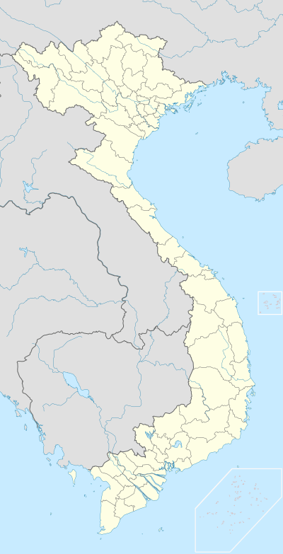
 Location in northern Vietnam | |
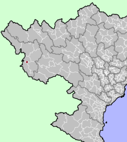
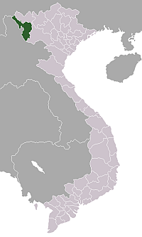
 Điện Biên Phủ Location of Điện Biên in Vietnam | |
| Coordinates: 21°23′N 103°1′E | |
| Country | |
| Province | Điện Biên |
| Area | |
| • Total | 64.27 km2 (24.81 sq mi) |
| Population | |
| • Total | 73,000 |
| • Density | 1,100/km2 (2,900/sq mi) |
| Time zone | UTC+7 (Indochina Time) |
| Climate | Cwa |
Population
Statistics on Điện Biên Phủ's population vary depending on definitions—figures are generally between 70,000 and 125,000. The city is growing quickly, and is projected to have a population of 150,000 by 2020.[1] The majority of the population is not ethnically Vietnamese—rather, Thai ethnic groups form the largest segment. Ethnic Vietnamese make up around a third of the population, with the remainder being Hmong, Si La, or others.
Location within Vietnam
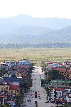
Điện Biên Phủ lies in Mường Thanh Valley, a 20 km (12 mi)) long and 6 km (3.7 mi) wide basin sometimes described as "heart-shaped." It is on the western edge of Điện Biên Province, of which it is the capital, and is only about 10 kilometres (6.2 mi) from the border with Laos. Until the creation of the province in 2004, it was part of Lai Châu Province. The Vietnamese government elevated Điện Biên Phủ to town status in 1992, and to city status in 2003.
Transport
National Route 12 connects Điện Biên to Lai Châu. Điện Biên Phủ Airport serves the city with air route to Hanoi.
History
The 8th century Thai locality of Muang Then is believed to have been centered here.
Nineteenth and early twentieth century
Điện Biên Phủ was rather politically removed from central Vietnamese control until 1841. In this year, under the Nguyễn dynasty, Điện Biên Phủ was directly incorporated into the Vietnamese political system when they established the town as an administrative district. This was partly done for more direct control of the region and to stop bandits who were exploiting the opium trade.[2]
In 1887, Điện Biên Phủ became a French protectorate. To ensure that the French would control the local opium trade, they appointed a sole administrator to supervise the trade and control the town. Other than a Hmong rebellion in 1918, the town was under French control until the Japanese occupied it during World War II. By early May 1945, the Japanese occupied Điện Biên Phủ and planned to convert it into a large military base. However, with an airstrip barely being enlarged, Chinese nationalist troops took the town in August of the same year. Subsequently, the nationalist forces then gave way to returning French troops.[2]
Operation Castor (1953)
In the 1950s, the town was known for its famous opium traffic, generating 500,000,000 French francs annually. It was also an extensive source of rice for the Việt Minh.[3]
The region was fortified in November 1953 by the French Union force in the biggest airborne operation of the 1946–1954 First Indochina War, Operation Castor, to block Việt Minh transport routes and to set the stage to draw out Việt Minh forces.
Siege of Điện Biên Phủ (1954)
The following year, the important Battle of Điện Biên Phủ was fought between the Việt Minh (led by General Võ Nguyên Giáp), and the French Union (led by General Henri Navarre, successor to General Raoul Salan). The siege of the French garrison lasted fifty-seven days, from 17:30, 13 March to 17:30, 7 May 1954. The southern outpost or fire base of "Camp Isabelle" did not follow the cease-fire order and fought until 01:00 the following day. The long-scheduled Geneva Meeting's Indochina conference involving the United States, the UK, the French Union and the USSR had already begun on 26 April 1954.[4][5]
The battle was significant beyond the valleys of Điện Biên Phủ. Giáp's victory ended major French involvement in Indochina and led to the Geneva accords which partitioned Vietnam into North and South.
Climate
| Climate data for Điện Biên Phủ | |||||||||||||
|---|---|---|---|---|---|---|---|---|---|---|---|---|---|
| Month | Jan | Feb | Mar | Apr | May | Jun | Jul | Aug | Sep | Oct | Nov | Dec | Year |
| Record high °C (°F) | 32.4 (90.3) |
33.9 (93.0) |
36.1 (97.0) |
38.5 (101.3) |
38.6 (101.5) |
37.9 (100.2) |
36.0 (96.8) |
35.2 (95.4) |
35.0 (95.0) |
35.5 (95.9) |
32.4 (90.3) |
31.2 (88.2) |
38.6 (101.5) |
| Average high °C (°F) | 23.7 (74.7) |
25.9 (78.6) |
29.1 (84.4) |
30.9 (87.6) |
31.6 (88.9) |
31.0 (87.8) |
30.3 (86.5) |
30.2 (86.4) |
30.2 (86.4) |
28.9 (84.0) |
26.3 (79.3) |
23.6 (74.5) |
28.5 (83.3) |
| Daily mean °C (°F) | 16.3 (61.3) |
18.0 (64.4) |
20.9 (69.6) |
23.7 (74.7) |
25.5 (77.9) |
26.0 (78.8) |
25.8 (78.4) |
25.5 (77.9) |
24.7 (76.5) |
22.6 (72.7) |
19.4 (66.9) |
16.2 (61.2) |
22.1 (71.8) |
| Average low °C (°F) | 12.1 (53.8) |
13.1 (55.6) |
15.5 (59.9) |
19.0 (66.2) |
21.6 (70.9) |
23.2 (73.8) |
23.2 (73.8) |
22.8 (73.0) |
21.6 (70.9) |
19.1 (66.4) |
15.4 (59.7) |
12.0 (53.6) |
18.2 (64.8) |
| Record low °C (°F) | −1.3 (29.7) |
4.8 (40.6) |
5.3 (41.5) |
11.4 (52.5) |
14.8 (58.6) |
17.4 (63.3) |
18.7 (65.7) |
10.7 (51.3) |
15.0 (59.0) |
7.7 (45.9) |
4.0 (39.2) |
0.4 (32.7) |
−1.3 (29.7) |
| Average precipitation mm (inches) | 21 (0.8) |
31 (1.2) |
55 (2.2) |
111 (4.4) |
187 (7.4) |
274 (10.8) |
310 (12.2) |
313 (12.3) |
151 (5.9) |
65 (2.6) |
31 (1.2) |
21 (0.8) |
1,570 (61.8) |
| Average precipitation days | 4.8 | 4.0 | 5.8 | 12.4 | 17.1 | 20.3 | 22.4 | 21.3 | 13.4 | 8.7 | 5.5 | 3.7 | 139.4 |
| Average relative humidity (%) | 82.7 | 79.7 | 79.2 | 81.0 | 81.9 | 84.6 | 86.3 | 87.4 | 86.4 | 84.9 | 83.5 | 83.4 | 83.4 |
| Mean monthly sunshine hours | 163 | 175 | 205 | 206 | 203 | 142 | 131 | 146 | 172 | 173 | 158 | 161 | 2,035 |
| Source: Vietnam Institute for Building Science and Technology[6] | |||||||||||||
See also
Notes
- Điện Biên Phủ: Development and Conservation in a Vietnamese Cultural Landscape, by William Logan. Paper Presented at the Forum UNESCO University and Heritage. 10th International Seminar "Cultural Landscapes in the 21st Century". Newcastle upon Tyne, 11–16 April 2005. Revised: July 2006.
- Schellinger, Paul; Salkin, Robert, eds. (1996). International Dictionary of Historic Places, Volume 5: Asia and Oceania. Chicago: Fitzroy Dearborn Publishers. p. 230. ISBN 1-884964-04-4.
- The Last Valley, Martin Windrow, 2004
- J. A. S. Grenville, page 407 The Collins History of the World in the Twentieth Century, ISBN 0 00 255169 1
- Forbes, Andrew, and Henley, David: Vietnam Past and Present: The North (History and culture of Hanoi and Tonkin). Chiang Mai. Cognoscenti Books, 2012. ASIN: B006DCCM9Q.
- "Vietnam Building Code Natural Physical & Climatic Data for Construction" (PDF). Vietnam Institute for Building Science and Technology. Archived from the original (PDF) on 22 July 2018. Retrieved 31 July 2018.
External links
| Wikimedia Commons has media related to Dien Bien Phu. |
Media links
- (in French) The situation of Điện Biên Phủ, 50 years after the battle (French news, public channel France 2, 5 May 2004)Dinan Dinana inan
Capital: Điện Biên Phủ | ||
| Điện Biên Phủ |
|  |
| Mường Lay | ||
| Điện Biên |
| |
| Điện Biên Đông | ||
| Mường Ảng |
| |
| Mường Chà |
| |
| Mường Nhé | ||
| Nậm Pồ | ||
| Tủa Chùa | ||
| Tuần Giáo |
| |
Districts of Northwest Vietnam | ||
|---|---|---|
| Điện Biên Province | 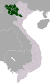 | |
| Hòa Bình Province | ||
| Lai Châu Province | ||
| Lào Cai Province | ||
| Sơn La Province | ||
| Yên Bái Province | ||
※ denotes provincial seat. | ||