Kon Tum
Kon Tum is the capital city of Kon Tum Province in Vietnam. It is located inland in the Central Highlands region of Vietnam, near the borders of Laos and Cambodia.
Kon Tum Thành phố Kon Tum | |
|---|---|
| Kon Tum City | |
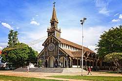 Kon Tum's wooden church | |
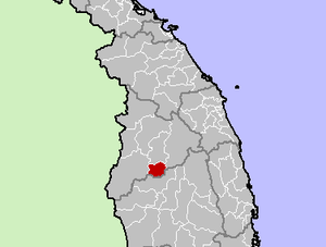 Location in Kon Tum Province | |
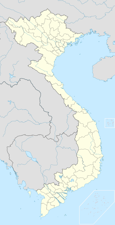 Kon Tum Location in Vietnam | |
| Coordinates: 14°23′N 107°59′E | |
| Country | |
| Province | Kon Tum |
| Area | |
| • Total | 432.9815 km2 (167.1751 sq mi) |
| Population (2019) | |
| • Total | 172,712 |
| • Density | 358/km2 (930/sq mi) |
| Climate | Aw |
History
After the People's Army of Vietnam invaded South Vietnam on March 30, 1972 during the Easter Offensive, two divisions attempted to capture Kon Tum, but failed. In March 1975, however, Kon Tum was overrun during the Ho Chi Minh Campaign and large numbers of refugees were forced to flee east to the south central coast.
Kon Tum has several vestiges of the French colonial period, as well as several tribal villages directly in the suburbs of the Vietnamese-reconstructed town. Among the town's landmarks, there is a Roman Catholic wooden church on discrete stilts and a large French-built seminary which hosts a small museum on local hill tribes. French missionary presence in Kon Tum traces back to 1851.
Climate
| Climate data for Kon Tum | |||||||||||||
|---|---|---|---|---|---|---|---|---|---|---|---|---|---|
| Month | Jan | Feb | Mar | Apr | May | Jun | Jul | Aug | Sep | Oct | Nov | Dec | Year |
| Record high °C (°F) | 33.9 (93.0) |
36.2 (97.2) |
37.1 (98.8) |
37.9 (100.2) |
39.0 (102.2) |
35.6 (96.1) |
33.7 (92.7) |
33.3 (91.9) |
32.6 (90.7) |
33.5 (92.3) |
33.0 (91.4) |
32.8 (91.0) |
39.0 (102.2) |
| Average high °C (°F) | 28.0 (82.4) |
30.2 (86.4) |
32.5 (90.5) |
33.1 (91.6) |
31.5 (88.7) |
29.5 (85.1) |
28.9 (84.0) |
28.7 (83.7) |
28.9 (84.0) |
28.8 (83.8) |
27.7 (81.9) |
26.8 (80.2) |
29.6 (85.3) |
| Daily mean °C (°F) | 20.6 (69.1) |
22.4 (72.3) |
24.5 (76.1) |
25.7 (78.3) |
25.3 (77.5) |
24.8 (76.6) |
24.3 (75.7) |
24.1 (75.4) |
23.9 (75.0) |
23.4 (74.1) |
22.2 (72.0) |
20.7 (69.3) |
23.5 (74.3) |
| Average low °C (°F) | 14.5 (58.1) |
16.3 (61.3) |
18.6 (65.5) |
20.9 (69.6) |
21.8 (71.2) |
21.9 (71.4) |
21.6 (70.9) |
21.5 (70.7) |
21.0 (69.8) |
19.6 (67.3) |
17.7 (63.9) |
15.5 (59.9) |
19.2 (66.6) |
| Record low °C (°F) | 5.5 (41.9) |
7.9 (46.2) |
8.7 (47.7) |
15.5 (59.9) |
18.0 (64.4) |
18.8 (65.8) |
18.1 (64.6) |
18.0 (64.4) |
16.3 (61.3) |
11.9 (53.4) |
8.9 (48.0) |
5.9 (42.6) |
5.5 (41.9) |
| Average precipitation mm (inches) | 1 (0.0) |
10 (0.4) |
28 (1.1) |
93 (3.7) |
220 (8.7) |
259 (10.2) |
293 (11.5) |
325 (12.8) |
295 (11.6) |
177 (7.0) |
62 (2.4) |
9 (0.4) |
1,771 (69.7) |
| Average precipitation days | 0.4 | 1.2 | 4.0 | 9.8 | 18.5 | 21.2 | 23.8 | 25.8 | 22.7 | 14.1 | 6.0 | 1.2 | 148.2 |
| Average relative humidity (%) | 71.6 | 68.0 | 68.0 | 72.9 | 80.0 | 85.2 | 86.2 | 87.8 | 86.9 | 82.6 | 77.7 | 73.8 | 78.4 |
| Mean monthly sunshine hours | 267 | 248 | 271 | 231 | 197 | 148 | 134 | 129 | 122 | 179 | 208 | 241 | 2,374 |
| Source: Vietnam Institute for Building Science and Technology[1] | |||||||||||||
References
- "Vietnam Building Code Natural Physical & Climatic Data for Construction" (PDF). Vietnam Institute for Building Science and Technology. Archived from the original (PDF) on 22 July 2018. Retrieved 20 July 2018.
External links
- Kontum government home page (Vietnamese)
- The Battle of Kontum

Districts of Vietnam Central Highlands | ||
|---|---|---|
| Đắk Lắk Province |
|  |
| Đắk Nông Province | ||
| Gia Lai Province | ||
| Kon Tum Province | ||
| Lâm Đồng Province | ||
※ denotes provincial seat. | ||