Cam Ranh
Cam Ranh (![]()
Cam Ranh Thành phố Cam Ranh | |
|---|---|
| Cam Ranh City | |
.jpg) A resort in Cam Ranh | |
 Seal | |
 Cam Ranh Location of in Vietnam | |
| Coordinates: 11°54′49″N 109°8′13″E | |
| Country | |
| Province | Khánh Hòa |
| Capital | Cam Ranh |
| Area | |
| • Total | 316 km2 (122 sq mi) |
| Population (2003) | |
| • Total | 121,050 |
| Time zone | UTC+7 (Indochina Time) |
| Climate | Aw |
| Website | http://saobiencamranh.net |
Geography
It is the second-largest city in the province, after Nha Trang. It is located on Cam Ranh Bay. As of 2009 the city had a population of 121,050[1] and covered an area of 316 km².[2]
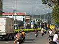 Street in Cam Ranh
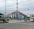 Post office
Infrastructures
- Cam Ranh International Airport
- Ba Ngòi Port
Climate
Cam Ranh has a tropical savanna climate (Köppen climate classification: As).[3][4]
| Climate data for Cam Ranh | |||||||||||||
|---|---|---|---|---|---|---|---|---|---|---|---|---|---|
| Month | Jan | Feb | Mar | Apr | May | Jun | Jul | Aug | Sep | Oct | Nov | Dec | Year |
| Record high °C (°F) | 31.5 (88.7) |
33.0 (91.4) |
33.9 (93.0) |
37.1 (98.8) |
38.1 (100.6) |
37.7 (99.9) |
37.4 (99.3) |
39.0 (102.2) |
37.3 (99.1) |
33.4 (92.1) |
32.4 (90.3) |
32.0 (89.6) |
39.0 (102.2) |
| Average high °C (°F) | 28.1 (82.6) |
29.4 (84.9) |
30.9 (87.6) |
32.2 (90.0) |
33.1 (91.6) |
33.2 (91.8) |
33.1 (91.6) |
33.3 (91.9) |
31.9 (89.4) |
30.1 (86.2) |
28.6 (83.5) |
27.5 (81.5) |
31.0 (87.8) |
| Daily mean °C (°F) | 24.3 (75.7) |
24.9 (76.8) |
26.4 (79.5) |
27.9 (82.2) |
28.8 (83.8) |
28.9 (84.0) |
28.7 (83.7) |
28.6 (83.5) |
27.7 (81.9) |
26.6 (79.9) |
25.7 (78.3) |
24.5 (76.1) |
26.9 (80.4) |
| Average low °C (°F) | 21.7 (71.1) |
22.0 (71.6) |
23.1 (73.6) |
24.7 (76.5) |
25.5 (77.9) |
25.6 (78.1) |
25.3 (77.5) |
25.4 (77.7) |
24.6 (76.3) |
23.9 (75.0) |
23.3 (73.9) |
22.3 (72.1) |
24.0 (75.2) |
| Record low °C (°F) | 14.4 (57.9) |
16.4 (61.5) |
17.1 (62.8) |
19.9 (67.8) |
21.5 (70.7) |
21.1 (70.0) |
21.3 (70.3) |
21.0 (69.8) |
21.6 (70.9) |
19.3 (66.7) |
18.7 (65.7) |
15.7 (60.3) |
14.4 (57.9) |
| Average precipitation mm (inches) | 23 (0.9) |
6 (0.2) |
32 (1.3) |
29 (1.1) |
81 (3.2) |
62 (2.4) |
49 (1.9) |
50 (2.0) |
152 (6.0) |
305 (12.0) |
315 (12.4) |
140 (5.5) |
1,243 (48.9) |
| Average precipitation days | 4.7 | 2.5 | 1.9 | 3.4 | 8.2 | 8.0 | 7.7 | 8.7 | 13.7 | 15.4 | 14.2 | 10.8 | 99.2 |
| Average relative humidity (%) | 75.5 | 76.0 | 76.3 | 76.9 | 76.3 | 74.4 | 74.0 | 74.3 | 79.7 | 81.6 | 79.5 | 76.3 | 76.7 |
| Mean monthly sunshine hours | 227 | 238 | 286 | 266 | 255 | 217 | 234 | 224 | 200 | 182 | 167 | 175 | 2,672 |
| Source: Vietnam Institute for Building Science and Technology[5] | |||||||||||||
References
- "Archived copy" (PDF). Archived from the original (PDF) on 2011-07-22. Retrieved 2011-05-21.CS1 maint: archived copy as title (link)
- "Districts of Vietnam". Statoids. Retrieved March 20, 2009.
- Kottek, Markus; Grieser, Jürgen; Beck, Christoph; Rudolf, Bruno; Rubel, Franz (2006). "World Map of the Köppen-Geiger climate classification updated" (PDF). Meteorologische Zeitschrift. 15 (3): 259–263. Bibcode:2006MetZe..15..259K. doi:10.1127/0941-2948/2006/0130.
- Peel, M. C.; Finlayson B. L. & McMahon, T. A. (2007). "Updated world map of the Köppen–Geiger climate classification" (PDF). Hydrol. Earth Syst. Sci. 11 (5): 1633–1644. doi:10.5194/hess-11-1633-2007. ISSN 1027-5606.
- "Vietnam Building Code Natural Physical & Climatic Data for Construction" (PDF). Vietnam Institute for Building Science and Technology. Archived from the original (PDF) on 22 July 2018. Retrieved 20 July 2018.
External links
| Wikimedia Commons has media related to Cam Ranh. |
| Da Nang city |  | |
|---|---|---|
| Bình Định Province | ||
| Bình Thuận Province | ||
| Khánh Hòa Province |
| |
| Ninh Thuận Province | ||
| Phú Yên Province | ||
| Quảng Nam Province | ||
| Quảng Ngãi Province | ||
※ denotes provincial seat. / § Sovereignty over Hoàng Sa & Trường Sa archipelagoes is disputed as of 25 June 2020. | ||
This article is issued from Wikipedia. The text is licensed under Creative Commons - Attribution - Sharealike. Additional terms may apply for the media files.