Mjini Magharibi Region
| Urban West Region Mkoa wa Mjini Magharibi (Swahili) | |
|---|---|
| Region | |
| Mjini Magharibi Region | |
.jpg) Aerial view of Stone Town | |
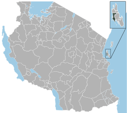 Location in Tanzania | |
| Country | Tanzania |
| Zone | Zanzibar |
| Capital | Zanzibar City |
| Area | |
| • Total | 230 km2 (90 sq mi) |
| Population (2012) | |
| • Total | 593,678 |
| • Density | 2,600/km2 (6,700/sq mi) |
| Time zone | UTC+3 (EAT) |
| Postcode | 71xxx |
| Area code(s) | 024 |
| Website |
zanzibar |
Mjini Magharibi Region (also known as the Zanzibar Urban West Region)[1] is one of the 31 regions of Tanzania. Located on the island of Unguja, Zanzibar City serves as the region's capital. According to the 2012 Tanzania National Census, the population of the Zanzibar Urban/West Region was 593,678.[2]
Administrative divisions
Districts
The region is administratively divided into two districts:
| Districts of Mjini Magharibi Region | ||
|---|---|---|
| Map | District | Population (2012) |
 |
Magharibi | 370,645 |
| Mjini | 223,033 | |
| Total | 593,678 | |
Constituencies
For parliamentary elections, Tanzania is divided into constituencies. As of the 2010 elections Zanzibar Urban/West Region had nineteen constituencies:[3]
- Amani Constituency (Urban)
- Bububu Constituency (West)
- Chumbuni Constituency (Urban)
- Dimani Constituency (West)
- Dole Constituency (West)
- Fuoni Constituency (West)
- Jang'ombe Constituency (Urban)
- Kiembesamaki Constituency (West)
- Kikwajuni Constituency (Urban)
- Kwahani Constituency (Urban)
- Kwamtipura Constituency (Urban)
- Magogoni Constituency (West)
- Magomeni Constituency (Urban)
- Mfenesini Constituency (West)
- Mji Mkongwe Constituency (Urban)
- Mpendae Constituency (Urban)
- Mtoni Constituency (West)
- Mwanakwerekwe Constituency (West)
- Raha Leo Constituency (Urban)
References
- ↑ Zanzibar Urban/West Region (Approved) at GEOnet Names Server, United States National Geospatial-Intelligence Agency
- ↑ "2002 Population and Housing General Report: Urban West". Archived from the original on 18 March 2004.
- ↑ "Organisations located in Zanzibar City - Tanzania". African Development Information.
| Mainland | ||
|---|---|---|
| Zanzibar | ||
Coordinates: 6°10′00″S 39°15′00″E / 6.1667°S 39.2500°E
This article is issued from
Wikipedia.
The text is licensed under Creative Commons - Attribution - Sharealike.
Additional terms may apply for the media files.