Yōrō, Gifu
| Yōrō 養老町 | |||
|---|---|---|---|
| Town | |||
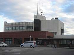 Yōrō Town Hall | |||
| |||
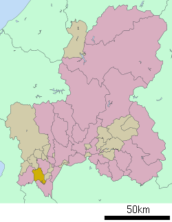 Location of Yōrō in Gifu Prefecture | |||
 Yōrō | |||
| Coordinates: 35°18′30.3″N 136°33′41″E / 35.308417°N 136.56139°ECoordinates: 35°18′30.3″N 136°33′41″E / 35.308417°N 136.56139°E | |||
| Country | Japan | ||
| Region | Chūbu | ||
| Prefecture | Gifu | ||
| District | Yōrō | ||
| Government | |||
| • Mayor | Takashi Ōhashi | ||
| Area | |||
| • Total | 72.29 km2 (27.91 sq mi) | ||
| Population (October 1, 2017) | |||
| • Total | 27,978 | ||
| • Density | 390/km2 (1,000/sq mi) | ||
| Time zone | UTC+9 (Japan Standard Time) | ||
| City symbols | |||
| - Tree | Buxus microphylla | ||
| - Flower | Chrysanthemum morifolium | ||
| Phone number | 0584-32-1100 | ||
| Address | Takada 798, Yōrō-chō, Yōrō-gun, Gifu-ken 503-1392 | ||
| Website | Official website | ||


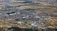
Yōrō (養老町 Yōrō-chō) is a town located in Yōrō District, Gifu Prefecture, Japan. As of 1 October 2017, the town had an estimated population of 27,978 and a population density of 390 persons per km2. The total area of the town was 57.09 square kilometres (22.04 sq mi).
Geography
Yōrō is located in south-west Gifu Prefecture, with the Yōrō Mountains to the west and the plains of the Ibi River to the east, The Makita River also flows through the town. The town has a climate characterized by characterized by hot and humid summers, and mild winters (Köppen climate classification Cfa). The average annual temperature in Yōrō is 15.3 °C. The average annual rainfall is 1840 mm with September as the wettest month.The temperatures are highest on average in August, at around 27.6 °C, and lowest in January, at around 4.1 °C.[1]
Neighbouring municipalities
Demographics
Per Japanese census data,[2] the population of Yōrō has remained fairly constant over the past 40 years.
| Census Year | Population |
|---|---|
| 1970 | 27,766 |
| 1980 | 31,371 |
| 1990 | 33,102 |
| 2000 | 33,256 |
| 2010 | 31,332 |
| 2015 | 29,029 |
History
The area around Yōrō was part of traditional Mino Province. With the post-Meiji restoration cadastral reforms, the town of Yōrō was established on April 1, 1897. Yōrō merged with the town of Takeda and villages of Hirohata, Kamitado, Ikebe, Kasago, Kobata, Tado, Hiyoshi and Aihara in 1954 to form the town of Yōrō. A referendum to merge into the city of Ōgaki was defeated in 2004.
Education
Yōrō has four public elementary schools and two public junior high schools operated by the town government, and one public high school operated by the Gifu Prefectural Board of Education.
Transportation
Railway
Highway
Sister city relations
Local attractions
- Mount Yōrō
- Yōrō Falls[3]
- Kikusui-Sen spring
- Yōrō Temple
- Reversible Destiny-Yoro Park is a theme park in Yōrō described as "an 'experience park' conceived on the theme of encountering the unexpected. By guiding visitors through various unexpected experiences as they walk through its component areas, the Site offers them opportunities to rethink their physical and spiritual orientation to the world." [4] The park was opened in October 1995.
- Tokai nature trail[5]
Local legends
- A local woodcutter discovered a stream that ran with fine sake. He filled a gourd and brought the liquid to his father. Drinking the liquid made his father feel youthful and turned his hair from gray to black. Empress Gensho of Nara visited Yōrō to try the liquid and it made her youthful, too.[3]
References
- ↑ Yōrō climate data
- ↑ Yōrō population statistics
- 1 2 "The Yoro Waterfall and the Legend of the Dutiful Son".
- ↑ "Reversible Destiny-Yoro Park Official Website".
- ↑ "Places to Visit - Yōrō".
- ↑ See Ross, Catrien; Japan (1996), Supernatural and Mysterious Japan: Spirits, Hauntings, and Paranormal Phenomena (1st ed.). Yenbooks. ISBN 4-900737-37-2.
- ↑ Emily Millar. "Creepy Japan".
Gallery
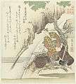 Yoro artwork
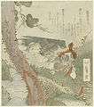 The Yoro Waterval
External links

- Yoro official website (in Japanese)
- "Color Yoro World" by Steven Kenworthy