Shirakawa, Gifu (town)
| Shirakawa 白川町 | |||
|---|---|---|---|
| Town | |||
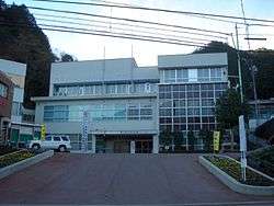 Shirakawa Town Hall | |||
| |||
 Location of Shirakawa in Gifu Prefecture | |||
 Shirakawa | |||
| Coordinates: 35°34′54.8″N 137°11′16.3″E / 35.581889°N 137.187861°ECoordinates: 35°34′54.8″N 137°11′16.3″E / 35.581889°N 137.187861°E | |||
| Country | Japan | ||
| Region | Chūbu | ||
| Prefecture | Gifu | ||
| District | Kamo | ||
| Government | |||
| • Mayor | Yoshihiro Imai | ||
| Area | |||
| • Total | 237.90 km2 (91.85 sq mi) | ||
| Population (December 1, 2017) | |||
| • Total | 8,550 | ||
| • Density | 36/km2 (93/sq mi) | ||
| Time zone | UTC+9 (Japan Standard Time) | ||
| City symbols | |||
| - Tree | Hinoki | ||
| - Flower | Azalea | ||
| Phone number | 0574-72-1311 | ||
| Address | Kawamata 715, Shirakawa-chō, Kamo-gun, Gifu-ken 509-1192 | ||
| Website | Official website (in Japanese) | ||


Shirakawa (白川町 Shirakawa-chō) is a town located in Kamo District, Gifu Prefecture, Japan. As of 1 December 2017, the town had an estimated population of 8,550 and a population density of 36 persons per km2, in 3185 households.[1] The total area of the town was 237.90 square kilometres (91.85 sq mi).
Geography
Shirakawa is in the lower reaches of the Japanese Alps in southern Gifu Prefecture. It lies nestled in valleys formed by several rivers, which combine to form the Shirakawa river at one end of the town. The rivers, though substantially developed and altered, remain a source of Ayu, a sweet river fish. The low mountains surrounding the town are heavily forested, primarily with evergreen trees. Japanese macaques, bears, and wild boar are known to live in the local forests. The town has a climate characterized by characterized by hot and humid summers, and mild winters (Köppen climate classification Cfa). The average annual temperature in Shirakawa is 11.4 °C. The average annual rainfall is 2238 mm with September as the wettest month.The temperatures are highest on average in August, at around 24.5 °C, and lowest in January, at around -0.9 °C.[2]
Neighbouring municipalities
- Gifu Prefecture
Demographics
Per Japanese census data,[3] the population of Shirakawa has declined steady over the past 40 years.
| Census Year | Population |
|---|---|
| 1970 | 14,059 |
| 1980 | 12,922 |
| 1990 | 12,118 |
| 2000 | 11,282 |
| 2010 | 9,530 |
History
The area around Shirakawa was part of traditional Mino Province. During the Edo period, it was largely controlled by Owari Domain under the Tokugawa shogunate. During the post-Meiji restoration cadastral reforms, the area was organised into Mugi District, Gifu. The village of Sakanohigashi was formed on April 1, 1897 with the establishment of the modern municipalities system. In 1953 the hamlet of Nishi-Shirakawa separated out to form the town of Shirakawa and joined Kamo District., and the following year Shirakawa annexed the remainder of Sakanohigashi village. In 1956, Shirakawa annexed the villages of Kurosawa, Sami, and Sahara.
Economy
The local economy is dominated by forestry and agriculture. Shirakawa is noted for its production of Hinoki wood, and also of green tea.
Education
Shirakawa has five public elementary schools and three public middle schools operated by the town government. The town does not have a high school.
Transportation
Railway
Highway
Sister city relations
References
External links

- Shirakawa official website (in Japanese)
| Core city | ||
|---|---|---|
| Cities | ||
| Districts | ||