Windellama
| Windellama New South Wales | |||||||||||||||
|---|---|---|---|---|---|---|---|---|---|---|---|---|---|---|---|
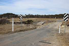 Oallen Ford Road at Nadgigomar Creek on border of Windellama and Oallen | |||||||||||||||
|
Windellama Location in New South Wales | |||||||||||||||
| Coordinates | 35°01′57″S 149°52′02″E / 35.03250°S 149.86722°ECoordinates: 35°01′57″S 149°52′02″E / 35.03250°S 149.86722°E | ||||||||||||||
| Population | 357 (2016 census)[1] | ||||||||||||||
| Postcode(s) | 2580 | ||||||||||||||
| Location | |||||||||||||||
| LGA(s) | Goulburn Mulwaree Council | ||||||||||||||
| County | Argyle | ||||||||||||||
| State electorate(s) | Goulburn | ||||||||||||||
| Federal Division(s) | Eden-Monaro | ||||||||||||||
| |||||||||||||||
Windellama is a rural locality in the Southern Tablelands of New South Wales, Australia in the Goulburn Mulwaree Council. It is northeast of Canberra and southeast of Goulburn.[2] At the 2016 census, it had a population of 357.[1]
References
| Wikimedia Commons has media related to Windellama. |
- 1 2 Australian Bureau of Statistics (27 June 2017). "Windellama". 2016 Census QuickStats. Retrieved 26 July 2017.

- ↑ "Windellama". Geographical Names Board of New South Wales. New South Wales Government. Retrieved 26 July 2017.
| Towns | |
|---|---|
| Localities and rural places |
|
Main Article: Local government areas of New South Wales | |
This article is issued from
Wikipedia.
The text is licensed under Creative Commons - Attribution - Sharealike.
Additional terms may apply for the media files.