The Ridgeway, New South Wales
| The Ridgeway New South Wales | |||||||||||||||
|---|---|---|---|---|---|---|---|---|---|---|---|---|---|---|---|
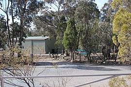 The fire station | |||||||||||||||
|
The Ridgeway Location in New South Wales | |||||||||||||||
| Coordinates | 35°20′22″S 149°15′33″E / 35.33944°S 149.25917°ECoordinates: 35°20′22″S 149°15′33″E / 35.33944°S 149.25917°E | ||||||||||||||
| Population | 163 (2016 census)[1] | ||||||||||||||
| Postcode(s) | 2620 | ||||||||||||||
| LGA(s) | Queanbeyan-Palerang Regional Council | ||||||||||||||
| County | Murray | ||||||||||||||
| Parish | Queanbeyan | ||||||||||||||
| State electorate(s) | Monaro | ||||||||||||||
| Federal Division(s) | Eden-Monaro | ||||||||||||||
| |||||||||||||||
The Ridgeway is a suburb of Queanbeyan, New South Wales, Australia. It is located on a ridge to the east of the central business district (CBD) on the Kings Highway.[2] When it was established it was part of the Yarrowlumla Shire. At the 2016 census, it had a population of 163.[1]
References
- 1 2 Australian Bureau of Statistics (27 June 2017). "The Ridgeway". 2016 Census QuickStats. Retrieved 20 July 2017.

- ↑ "The Ridgeway". Geographical Names Board of New South Wales. New South Wales Government. Retrieved 20 July 2017.
This article is issued from
Wikipedia.
The text is licensed under Creative Commons - Attribution - Sharealike.
Additional terms may apply for the media files.