Monga National Park
| Monga National Park New South Wales | |
|---|---|
|
IUCN category II (national park) | |
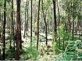 Eucalyptus forest at Monga National Park | |
 Monga National Park | |
| Nearest town or city | Braidwood. |
| Coordinates | 35°39′47″S 149°58′16″E / 35.66306°S 149.97111°ECoordinates: 35°39′47″S 149°58′16″E / 35.66306°S 149.97111°E |
| Established | 1 January 2001 |
| Area | 251.44 km2 (97.1 sq mi) |
| Managing authorities | National Parks and Wildlife Service |
| Website | Monga National Park |
| See also |
Protected areas of New South Wales |
The Monga National Park is a 251.44-square-kilometre (97.08 sq mi) national park located 230 kilometres (140 mi) south west of Sydney, New South Wales, Australia. The closest town nearby is Braidwood.[1]
Monga features outstanding high altitude eucalyptus forest and cool temperate rainforest.
Gallery
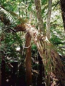
 Southern Sassafras at Monga National Park; a seldom seen plant in New South Wales
 The Monga Waratah at Monga National Park
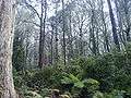 A stand of Eucalyptus trees at Monga National park
See also
References
![]()
This article is issued from
Wikipedia.
The text is licensed under Creative Commons - Attribution - Sharealike.
Additional terms may apply for the media files.