Idledale, Colorado
| Idledale, Colorado | |
|---|---|
| Census-designated place | |
 Idledale in 2014 | |
 Location of Idledale in Jefferson County, Colorado | |
 Idledale Location of Idledale in Jefferson County, Colorado  Idledale Idledale (the US) | |
| Coordinates: 39°39′57″N 105°14′39″W / 39.66583°N 105.24417°WCoordinates: 39°39′57″N 105°14′39″W / 39.66583°N 105.24417°W | |
| Country |
|
| State |
|
| County | Jefferson[1] |
| Area | |
| • Total | 0.28 sq mi (0.72 km2) |
| • Land | 0.28 sq mi (0.72 km2) |
| • Water | 0.0 sq mi (0.0 km2) |
| Elevation[1] | 6,466 ft (1,971 m) |
| Population (2010) | |
| • Total | 252 |
| • Density | 910/sq mi (351.3/km2) |
| Time zone | UTC-7 (MST) |
| • Summer (DST) | UTC-6 (MDT) |
| ZIP code[2] | 80453 |
| GNIS feature ID | 204713 |
| FIPS code | 08-38480 |
Idledale is a census-designated place (CDP), unincorporated community, and a U.S. Post Office in Jefferson County, Colorado, United States.[3] The Idledale Post Office has the ZIP Code 80453.[2] As of the 2010 census, the population of the CDP was 252.[4]
History
Originally called "Starbuck Heights", the town was almost washed out by a storm in 1933. When it was rebuilt, the town became known as Idledale.[1]
Geography
Idledale is located at 39°39′57″N 105°14′39″W / 39.66583°N 105.24417°W (39.665971,-105.244045) on the north side of Bear Creek. Colorado State Highway 74 passes through the community as it traverses Bear Creek Canyon; to the east, the highway is known as Bear Creek Canyon Scenic Mountain Drive and leads downstream 4 miles (6 km) to Morrison; to the west the highway leads up the canyon the same distance to Kittredge.
According to the U.S. Census Bureau, the Idledale CDP has an area of 0.28 square miles (0.72 km2), all of it recorded as land.[4]
Demographics
| Historical population | |||
|---|---|---|---|
| Census | Pop. | %± | |
| U.S. Decennial Census[5] | |||
See also
References
- 1 2 3 "US Board on Geographic Names". United States Geological Survey. 2007-10-25. Retrieved 2008-01-31.
- 1 2 "ZIP Code Lookup". United States Postal Service. December 28, 2006. Archived from the original (JavaScript/HTML) on November 23, 2010. Retrieved December 28, 2006.
- ↑
- 1 2 "Geographic Identifiers: 2010 Census Summary File 1 (G001): Idledale CDP, Colorado". American Factfinder. U.S. Census Bureau. Retrieved April 26, 2018.
- ↑ "Census of Population and Housing". Census.gov. Retrieved June 4, 2016.
Municipalities and communities of Jefferson County, Colorado, United States | ||
|---|---|---|
| Cities | 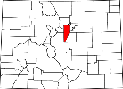 | |
| Towns | ||
| CDPs | ||
| Unincorporated communities | ||
| Ghost town | ||
| Footnotes | ‡This populated place also has portions in an adjacent county or counties | |