Dupont, Colorado
| Dupont, Colorado | |
|---|---|
| Unincorporated community | |
 Dupont, Colorado Location within the state of Colorado | |
| Coordinates: 39°50′17″N 104°54′45″W / 39.83806°N 104.91250°WCoordinates: 39°50′17″N 104°54′45″W / 39.83806°N 104.91250°W | |
| Country |
|
| State |
|
| County | Adams County[1] |
| Elevation[1] | 5,144 ft (1,568 m) |
| Time zone | UTC-7 (MST) |
| • Summer (DST) | UTC-6 (MDT) |
| ZIP code[2] | 80024 |
| Area code(s) | Both 303 and 720 |
Dupont is an unincorporated community and U.S. Post Office in Adams County, Colorado, United States. The Dupont Post Office has the ZIP Code 80024.[2]
A post office called Dupont has been in operation since 1926.[3] The community takes its name from the DuPont Company, which owned property near the original town site.[4]
Geography
Dupont is located at 39°50′17″N 104°54′45″W / 39.83806°N 104.91250°W (39.838068,-104.912567).
See also
References
- 1 2 "US Board on Geographic Names". United States Geological Survey. 2007-10-25. Retrieved 2008-01-31.
- 1 2 "ZIP Code Lookup". United States Postal Service. December 15, 2006. Archived from the original (JavaScript/HTML) on November 23, 2010. Retrieved December 15, 2006.
- ↑ "Post offices". Jim Forte Postal History. Archived from the original on 6 March 2016. Retrieved 25 June 2016.
- ↑ Dawson, John Frank. Place names in Colorado: why 700 communities were so named, 150 of Spanish or Indian origin. Denver, CO: The J. Frank Dawson Publishing Co. p. 19.
Municipalities and communities of Adams County, Colorado, United States | ||
|---|---|---|
| Cities | 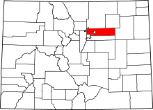 | |
| Towns | ||
| CDPs | ||
| Unincorporated communities | ||
| Footnotes | ‡This populated place also has portions in an adjacent county or counties | |
This article is issued from
Wikipedia.
The text is licensed under Creative Commons - Attribution - Sharealike.
Additional terms may apply for the media files.