Lakeside, Colorado
| Town of Lakeside, Colorado | |
|---|---|
| Statutory Town | |
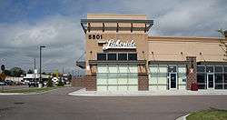 The municipal offices of the Town of Lakeside. | |
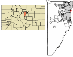 Location of Lakeside in Jefferson County, Colorado. | |
| Coordinates: 39°47′00″N 105°03′25″W / 39.78333°N 105.05694°WCoordinates: 39°47′00″N 105°03′25″W / 39.78333°N 105.05694°W | |
| Country |
|
| State |
|
| County | Jefferson County[1] |
| Incorporated | November 25, 1907[2] |
| Government | |
| • Type | Statutory Town[1] |
| Area[3] | |
| • Total | 0.25 sq mi (0.64 km2) |
| • Land | 0.19 sq mi (0.49 km2) |
| • Water | 0.06 sq mi (0.16 km2) |
| Elevation[4] | 5,364 ft (1,635 m) |
| Population (2010) | |
| • Total | 8 |
| • Estimate (2016)[5] | 8 |
| • Density | 42.55/sq mi (16.46/km2) |
| Time zone | UTC-7 (MST) |
| • Summer (DST) | UTC-6 (MDT) |
| ZIP code[6] | Denver CO 80212 |
| Area code(s) | Both 303 and 720 |
| FIPS code | 08-42495 |
| GNIS feature ID | 1669462 |
|
| |
The Town of Lakeside is a Statutory Town in Jefferson County, Colorado, United States. The town population was 8 at the 2010 United States Census, making Lakeside the least populous municipality in the State of Colorado.[7] Lakeside is immediately west of the City and County of Denver, the most populous municipality in the state. The Denver Post Office (ZIP Code 80212) serves Lakeside.[6]
The town's namesake lake is Lake Rhoda, which covers 20% of its total area. A year after its incorporation on November 12, 1907, the Lakeside Amusement Park, nicknamed "White City", opened on the eastern shores. Both town and park were founded by a syndicate led by prominent Denver brewer Adolph Zang, who endeavored to build the resort just across the county line from Denver, and incorporate to move beyond the reach of Denver liquor laws. Also in town on the southern shore is Lakeside Mall, built in 1956. The amusement park, shopping mall (the shopping mall was razed approximately in 2010 and a Wal-Mart now sits on the site), and lake occupy almost all the tiny municipality. Residences are limited to a handful of houses in the southeast corner of the town occupied by employees of the amusement park.
Geography
Lakeside is located at 39°47′0″N 105°3′25″W / 39.78333°N 105.05694°W. According to the United States Census Bureau, the town has a total area of 0.2 square miles (0.52 km2), of which, 0.2 square miles (0.52 km2) of it is land and 0.1 square miles (0.26 km2) of it (20.83%) is water.
Demographics
| Historical population | |||
|---|---|---|---|
| Census | Pop. | %± | |
| 1910 | 103 | — | |
| 1920 | 36 | −65.0% | |
| 1930 | 49 | 36.1% | |
| 1940 | 39 | −20.4% | |
| 1950 | 46 | 17.9% | |
| 1960 | 28 | −39.1% | |
| 1970 | 17 | −39.3% | |
| 1980 | 19 | 11.8% | |
| 1990 | 11 | −42.1% | |
| 2000 | 20 | 81.8% | |
| 2010 | 8 | −60.0% | |
| Est. 2016 | 8 | [5] | 0.0% |
| U.S. Decennial Census[8] | |||
As of the census[9] of 2000, there were 20 people, 9 households, and 5 families residing in the town. There were 9 housing units. The racial makeup of the town was 100.00% White. Hispanic or Latino of any race were 00.00% of the population.
There were 9 households out of which 22.2% had children under the age of 18 living with them, 33.3% were married couples living together, and 44.4% were non-families. 22.2% of all households were made up of individuals and none had someone living alone who was 65 years of age or older. The average household size was 2.22 and the average family size was 2.60.
In the town, the population was spread out with 15.0% under the age of 18, 15.0% from 18 to 24, 20.0% from 25 to 44, 30.0% from 45 to 64, and 20.0% who were 65 years of age or older. The median age was 44 years. The median income for a household in the town was $34,375, and the median income for a family was $9,375. Males had a median income of $20,625 versus $0 for females. The per capita income for the town was $16,339. There are 66.7% of families living below the poverty line and 44.4% of the population, including 100.0% of under eighteens and none of those over 64.
See also
References
- 1 2 "Active Colorado Municipalities". State of Colorado, Department of Local Affairs. Archived from the original on 2010-11-23. Retrieved 2007-11-30.
- ↑ "Colorado Municipal Incorporations". State of Colorado, Department of Personnel & Administration, Colorado State Archives. 2004-12-01. Retrieved 2007-11-30.
- ↑ "2016 U.S. Gazetteer Files". United States Census Bureau. Retrieved Jul 25, 2017.
- ↑ "US Board on Geographic Names". United States Geological Survey. 2007-10-25. Retrieved 2008-01-31.
- 1 2 "Population and Housing Unit Estimates". Retrieved June 9, 2017.
- 1 2 "ZIP Code Lookup". United States Postal Service. December 14, 2006. Archived from the original (JavaScript/HTML) on November 23, 2010. Retrieved December 14, 2006.
- ↑ "American FactFinder". U.S. Census Bureau. Retrieved March 4, 2011.
- ↑ "Census of Population and Housing". Census.gov. Retrieved June 4, 2015.
- ↑ "American FactFinder". United States Census Bureau. Retrieved 2008-01-31.
External links
- CDOT map of the Town of Lakeside
- Lakeside Mall Developer
- Lakeside, Colorado is at coordinates 39°47′0″N 105°3′25″W / 39.78333°N 105.05694°W.
Municipalities and communities of Jefferson County, Colorado, United States | ||
|---|---|---|
| Cities |  | |
| Towns | ||
| CDPs | ||
| Unincorporated communities | ||
| Ghost town | ||
| Footnotes | ‡This populated place also has portions in an adjacent county or counties | |