Dakota Ridge, Colorado
| Dakota Ridge, Colorado | |
|---|---|
| Census-designated place | |
 Dakota Ridge  Dakota Ridge | |
| Coordinates: 39°37′7″N 105°8′6″W / 39.61861°N 105.13500°WCoordinates: 39°37′7″N 105°8′6″W / 39.61861°N 105.13500°W | |
| Country |
|
| State |
|
| County | Jefferson |
| Government | |
| • Type | Unincorporated community |
| Area | |
| • Total | 9.6 sq mi (24.8 km2) |
| • Land | 9.3 sq mi (24.0 km2) |
| • Water | 0.3 sq mi (0.8 km2) |
| Elevation[1] | 5,780 ft (1,760 m) |
| Population (2010) | |
| • Total | 32,005 |
| • Density | 3,450/sq mi (1,332.2/km2) |
| Time zone | UTC-7 (MST) |
| • Summer (DST) | UTC-6 (MDT) |
| Area code(s) | 303 and 720 |
| FIPS code | 08-19150 |
| GNIS feature ID | 2583230 |
Dakota Ridge is a census-designated place (CDP) in Jefferson County, Colorado, United States. The population as of the 2010 census was 32,005.[2]
Geography
Dakota Ridge is bordered to the east by Denver, to the north by Lakewood, and to the south by unincorporated Ken Caryl. It is bordered to the west by the Dakota Hogback, a sharp hogback ridge that to the north near Morrison is known as Dinosaur Ridge.
Colorado State Highway 470, part of the beltway around Denver, runs through the western part of the community, leading north to Golden and southeast to Littleton. Downtown Denver is 17 miles (27 km) to the northeast.
According to the U.S. Census Bureau, the Dakota Ridge CDP has a total area of 9.6 square miles (24.8 km2), of which 9.3 square miles (24.0 km2) are land and 0.3 square miles (0.8 km2), or 3.27%, are water.[2]
Demographics
| Historical population | |||
|---|---|---|---|
| Census | Pop. | %± | |
| U.S. Decennial Census[3] | |||
See also
References
- ↑ "US Board on Geographic Names". United States Geological Survey. 2007-10-25. Retrieved 2008-01-31.
- 1 2 "Geographic Identifiers: 2010 Census Summary File 1 (G001): Dakota Ridge CDP, Colorado". American Factfinder. U.S. Census Bureau. Retrieved April 26, 2018.
- ↑ "Census of Population and Housing". Census.gov. Retrieved June 4, 2016.
Municipalities and communities of Jefferson County, Colorado, United States | ||
|---|---|---|
| Cities | 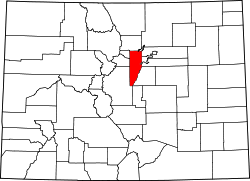 | |
| Towns | ||
| CDPs | ||
| Unincorporated communities | ||
| Ghost town | ||
| Footnotes | ‡This populated place also has portions in an adjacent county or counties | |