West Turin, New York
| West Turin, New York | |
|---|---|
| Town | |
 West Turin, New York Location within the state of New York | |
| Coordinates: 43°35′0″N 75°27′49″W / 43.58333°N 75.46361°WCoordinates: 43°35′0″N 75°27′49″W / 43.58333°N 75.46361°W | |
| Country | United States |
| State | New York |
| County | Lewis |
| Area[1] | |
| • Total | 102.40 sq mi (265.21 km2) |
| • Land | 102.05 sq mi (264.32 km2) |
| • Water | 0.34 sq mi (0.89 km2) |
| Elevation | 1,857 ft (566 m) |
| Population (2010) | |
| • Total | 1,524 |
| • Estimate (2016)[2] | 1,515 |
| • Density | 14.85/sq mi (5.73/km2) |
| Time zone | UTC-5 (Eastern (EST)) |
| • Summer (DST) | UTC-4 (EDT) |
| ZIP code | 13325 |
| Area code(s) | 315 |
| FIPS code | 36-049-81094 |
| GNIS feature ID | 979628[3] |
West Turin is a town in Lewis County, New York, United States. The population was 1,524 at the 2010 census. The name is derived from its parent town, Turin.
The Town of West Turin is in the south-central part of the county and is north of Rome.
History
The town was first settled around 1796, near Constableville.
West Turin was formed from part of Town of Turin in 1830 and was subsequently reduced in size by the formation of newer towns: Montague (1850) and Osceola (1844). The Town of West Turin now includes the former "Town of Highmarket," which was disbanded in 1973. Highmarket had been set apart from West Turin in 1852.
Geography
According to the United States Census Bureau, the town has a total area of 102.4 square miles (265 km2), of which 102.2 square miles (265 km2) is land and 0.2 square miles (0.52 km2) (0.18%) is water.
The Black River forms the east town line. West Turin is on the Tug Hill Plateau of northwestern New York.
New York State Route 26 and New York State Route 12D are north-south highways. New York State Route 12 is a north-south highway near the Black River.
climate
West Turin has a humid continental climate (Dfb). Winter is cold and very snowy, with most days not making it to freezing. Snow can fall anytime from October to May and a consistent snowpack is expected from November to April. Due to its elevation, it is one of the coldest, snowiest and wettest places in the state. Summer is warm during the day, but it cools off quickly at night. While West Turin is very wet year round, spring is the driest time of year with 3-5” per month while fall is the wettest time of year with 5-6” per month.
The highest recorded temperature is 94 on June 28, 2005 and August 10, 2001. The coldest recorded temperature is -40 on January 25, 26, and 27 in 2004. The highest minimum temperature is 69 on July 18, 2005, July 19, 2013, and July 22, 2011. The lowest high on record is -15 on January 16, 2004.
The low falls below freezing on an average of 190 days per year and it falls below 0 on 39. The average lowest temp in a year is -29, putting West Turin in hardiness zone 4A. The high stays below freezing on an average of 69 days per year and exceeds 90 on 1.6 days per year.
| Climate data for Highmarket, NY (precipitation 1981-2010, temps 2000-2017 | |||||||||||||
|---|---|---|---|---|---|---|---|---|---|---|---|---|---|
| Month | Jan | Feb | Mar | Apr | May | Jun | Jul | Aug | Sep | Oct | Nov | Dec | Year |
| Record high °F (°C) | 55 (13) |
59 (15) |
75 (24) |
84 (29) |
90 (32) |
94 (34) |
92 (33) |
94 (34) |
88 (31) |
81 (27) |
69 (21) |
61 (16) |
94 (34) |
| Average high °F (°C) | 24.2 (−4.3) |
27.1 (−2.7) |
36.8 (2.7) |
50.6 (10.3) |
64.5 (18.1) |
72.9 (22.7) |
77.5 (25.3) |
76.0 (24.4) |
68.5 (20.3) |
54.3 (12.4) |
42.3 (5.7) |
29.8 (−1.2) |
52 (11.1) |
| Average low °F (°C) | 3.8 (−15.7) |
4.0 (−15.6) |
12.7 (−10.7) |
27.2 (−2.7) |
38.4 (3.6) |
47.2 (8.4) |
51.7 (10.9) |
50.3 (10.2) |
43.7 (6.5) |
34.7 (1.5) |
24.7 (−4.1) |
12.7 (−10.7) |
29.3 (−1.5) |
| Record low °F (°C) | −40 (−40) |
−36 (−38) |
−29 (−34) |
−5 (−21) |
18 (−8) |
28 (−2) |
35 (2) |
34 (1) |
20 (−7) |
11 (−12) |
−11 (−24) |
−28 (−33) |
−40 (−40) |
| Average precipitation inches (mm) | 4.82 (122.4) |
3.45 (87.6) |
3.60 (91.4) |
3.83 (97.3) |
4.55 (115.6) |
4.39 (111.5) |
4.56 (115.8) |
4.78 (121.4) |
5.81 (147.6) |
5.80 (147.3) |
5.25 (133.4) |
5.33 (135.4) |
56.17 (1,426.7) |
| Average snowfall inches (cm) | 58.6 (148.8) |
40.9 (103.9) |
26.7 (67.8) |
7.4 (18.8) |
0.2 (0.5) |
0.0 (0) |
0.0 (0) |
0.0 (0) |
0.0 (0) |
2.8 (7.1) |
19.3 (49) |
52.2 (132.6) |
208.1 (528.5) |
| Average precipitation days (≥ 0.01 in) | 19 | 16 | 15 | 13 | 14 | 13 | 13 | 13 | 14 | 16 | 16 | 19 | 181 |
| Average snowy days (≥ 0.1 in) | 18 | 15 | 11 | 5 | .3 | 0 | 0 | 0 | 0 | 2 | 8 | 17 | 76.3 |
| Source: NWS Nowdata from NWS Buffalo | |||||||||||||
Demographics
| Historical population | |||
|---|---|---|---|
| Census | Pop. | %± | |
| 1830 | 1,534 | — | |
| 1840 | 2,042 | 33.1% | |
| 1850 | 3,793 | 85.7% | |
| 1860 | 2,410 | −36.5% | |
| 1870 | 2,111 | −12.4% | |
| 1880 | 2,006 | −5.0% | |
| 1890 | 1,803 | −10.1% | |
| 1900 | 1,779 | −1.3% | |
| 1910 | 1,941 | 9.1% | |
| 1920 | 1,929 | −0.6% | |
| 1930 | 1,886 | −2.2% | |
| 1940 | 1,806 | −4.2% | |
| 1950 | 1,781 | −1.4% | |
| 1960 | 1,905 | 7.0% | |
| 1970 | 1,713 | −10.1% | |
| 1980 | 1,867 | 9.0% | |
| 1990 | 1,753 | −6.1% | |
| 2000 | 1,675 | −4.4% | |
| 2010 | 1,524 | −9.0% | |
| Est. 2016 | 1,515 | [2] | −0.6% |
| U.S. Decennial Census[4] | |||
As of the census[5] of 2000, there were 1,674 people, 635 households, and 433 families residing in the town. The population density was 16.4 people per square mile (6.3/km²). There were 971 housing units at an average density of 9.5 per square mile (3.7/km²). The racial makeup of the town was 99.22% White, 0.18% Native American, 0.06% Asian, 0.24% from other races, and 0.30% from two or more races. Hispanic or Latino of any race were 0.12% of the population.
There were 635 households out of which 31.2% had children under the age of 18 living with them, 51.8% were married couples living together, 10.1% had a female householder with no husband present, and 31.7% were non-families. 25.8% of all households were made up of individuals and 13.2% had someone living alone who was 65 years of age or older. The average household size was 2.64 and the average family size was 3.16.
In the town, the population was spread out with 27.4% under the age of 18, 7.9% from 18 to 24, 27.7% from 25 to 44, 22.2% from 45 to 64, and 14.9% who were 65 years of age or older. The median age was 38 years. For every 100 females, there were 104.9 males. For every 100 females age 18 and over, there were 101.7 males.
The median income for a household in the town was $35,150, and the median income for a family was $41,618. Males had a median income of $32,065 versus $21,838 for females. The per capita income for the town was $15,538. About 13.5% of families and 16.4% of the population were below the poverty line, including 19.8% of those under age 18 and 13.8% of those age 65 or over.
Communities and locations in West Turin
- Byron Corners – A location northwest of Mohawk Hill.
- Collinsville – A hamlet in the northeast part of the town, west of Lyons Falls village on NY-12D. The name is from Homer Collins, an early settler. Collinsville Cemetery was listed on the National Register of Historic Places in 2014.[6]
- Constableville – The Village of Constableville on NY-26 near the southeast town line.
- Fish Creek – A hamlet west of Mohawk Hill by the southwest town line.
- High Market – A location north of Byron Corners.
- Lyons Falls – Part of the Village of Lyons Falls is at the east town line and the Black River. The falls were formerly called the "High Falls."
- Michigan Mills – A hamlet in the western part of the town.
- Mohawk Hill – A hamlet in the south part of the town on NY-26.
- Page – A location in the northwest part of the town.
- Potters Corners – A location southwest of Collinsville at the junction of Routes NY-12D and NY-26.
References
- ↑ "2016 U.S. Gazetteer Files". United States Census Bureau. Retrieved Jul 5, 2017.
- 1 2 "Population and Housing Unit Estimates". Retrieved June 9, 2017.
- ↑ U.S. Geological Survey Geographic Names Information System: West Turin, New York
- ↑ "Census of Population and Housing". Census.gov. Retrieved June 4, 2015.
- ↑ "American FactFinder". United States Census Bureau. Retrieved 2008-01-31.
- ↑ "National Register of Historic Places Listings". Weekly List of Actions Taken on Properties: 5/05/14 through 5/09/14. National Park Service. 2014-05-16.
Municipalities and communities of Lewis County, New York, United States | ||
|---|---|---|
| Towns | 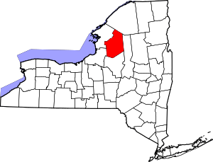 | |
| Villages | ||
| Other hamlets | ||