West Leyden, New York
| West Leyden, New York | |
|---|---|
| Hamlet | |
 West Leyden, New York  West Leyden, New York | |
| Coordinates: 43°27′34″N 75°27′50″W / 43.45944°N 75.46389°WCoordinates: 43°27′34″N 75°27′50″W / 43.45944°N 75.46389°W | |
| Country | United States |
| State | New York |
| County | Lewis |
| Elevation | 1,489 ft (454 m) |
| Time zone | UTC-5 (Eastern (EST)) |
| • Summer (DST) | UTC-4 (EDT) |
| ZIP code | 13489 |
| Area code(s) | 315 & 680 |
| GNIS feature ID | 970784[1] |
West Leyden is a hamlet in Lewis County, New York, United States. The community is located along the East Branch Mohawk River at the intersection of New York State Route 26 and New York State Route 294, 6.6 miles (10.6 km) west-southwest of Boonville. West Leyden has a post office with ZIP code 13489, which opened on December 16, 1826.[2][3]
References
- ↑ "West Leyden". Geographic Names Information System. United States Geological Survey.
- ↑ United States Postal Service. "USPS - Look Up a ZIP Code". Retrieved September 30, 2017.
- ↑ "Postmaster Finder - Post Offices by ZIP Code". United States Postal Service. Retrieved September 30, 2017.
Municipalities and communities of Lewis County, New York, United States | ||
|---|---|---|
| Towns | 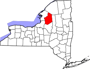 | |
| Villages | ||
| Other hamlets | ||
This article is issued from
Wikipedia.
The text is licensed under Creative Commons - Attribution - Sharealike.
Additional terms may apply for the media files.