West Grinstead
| West Grinstead | |
|---|---|
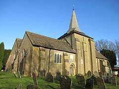 St. George's Church, West Grinstead | |
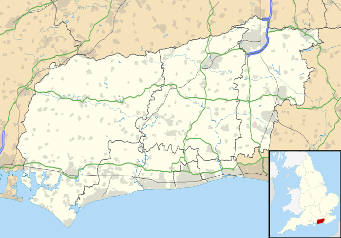 West Grinstead West Grinstead shown within West Sussex | |
| Area | 25.84 km2 (9.98 sq mi) [1] |
| Population |
2,934 [1] 2001 Census 3,054 (2011 Census)[2] |
| • Density | 114/km2 (300/sq mi) |
| OS grid reference | TQ171207 |
| • London | 38 miles (61 km) NNE |
| Civil parish |
|
| District | |
| Shire county | |
| Region | |
| Country | England |
| Sovereign state | United Kingdom |
| Post town | HORSHAM |
| Postcode district | RH13 |
| Dialling code | 01403 |
| Police | Sussex |
| Fire | West Sussex |
| Ambulance | South East Coast |
| EU Parliament | South East England |
| UK Parliament | |
| Website | www.WGPublications.com |
West Grinstead is a village and civil parish in the Horsham District of West Sussex, England. It lies just off the B2135 road four miles (6.3 km) northwest from Henfield. It is within the ancient division of the Rape of Bramber
The western River Adur flows through the village.
The parish of West Grinstead covers an area of 2584 hectares (6382 acres)and consists of the villages of West Grinstead, Littleworth, Partridge Green and Dial Post. In the 2001 census 2934 people lived in 1099 households, of whom 1547 were economically active. At the 2011 Census the population was 3,054[2]
The village should not be confused with the much larger town of East Grinstead which lies 17.5 miles (28 km) to the north-east.
Churches

The Shrine of Our Lady of Consolation dates from 1876 and is the Roman Catholic parish church. It is an important centre of Catholic pilgrimage in England. Two notable figures are buried in its grounds: Anglo-French writer and poet Hilaire Belloc (friend of fellow Catholic, G. K. Chesterton)[3] and English writer Antonia White.
St George's Church was first built circa 1100 AD and is the Anglican place of worship, and the Church of England parish church.
History

Knepp Castle is located to the west of the village near the A24. It was a motte and bailey castle and first built in the 12th century by William de Braose. In 1214 the castle was refortified with the addition of a stone keep on top of the motte. Some remains of the keep still stand.
The modern Knepp Castle nearby is a castellated mansion by John Nash.[4]
Leisure
The Downs Link long distance path runs through the parish and can be used for walking or cycling.
References
| Wikimedia Commons has media related to West Grinstead. |
- 1 2 "2001 Census: West Sussex – Population by Parish" (PDF). West Sussex County Council. Archived from the original (PDF) on 8 June 2011. Retrieved 12 April 2009.
- 1 2 "Civil Parish population 2011". Neighbourhood Statistics. Office for National Statistics. Retrieved 4 October 2016.
- ↑ Catholic Shrine
- ↑ "Knepp Castle". Pastscape. Retrieved 2011-06-15.