Upper Beeding
| Upper Beeding | |
|---|---|
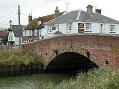 Beeding Bridge | |
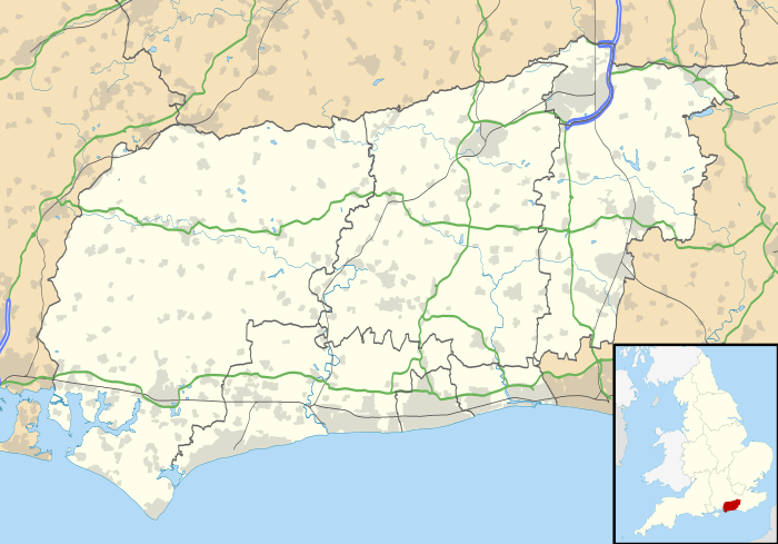 Upper Beeding Upper Beeding shown within West Sussex | |
| Area | 18.77 km2 (7.25 sq mi) [1] |
| Population |
3,798 [1] 2001 Census 3,763 (Census 2011)[2] |
| • Density | 202/km2 (520/sq mi) |
| OS grid reference | TQ193105 |
| • London | 43 miles (69 km) N |
| Civil parish |
|
| District | |
| Shire county | |
| Region | |
| Country | England |
| Sovereign state | United Kingdom |
| Post town | STEYNING |
| Postcode district | BN44 |
| Dialling code | 01903 |
| Police | Sussex |
| Fire | West Sussex |
| Ambulance | South East Coast |
| EU Parliament | South East England |
| UK Parliament | |
| Website | Upper Beeding Parish Council |
Upper Beeding is a village and civil parish in the Horsham District of West Sussex, England. It is located at the northern end of the River Adur gap in the South Downs four miles (6.4 km) north of Shoreham-by-Sea and has a land area of 1877 hectares (4637 acres). The site is a bridging point over the river: on the opposite bank are Bramber and Steyning, making the whole area somewhat built-up. The civil parish also includes the smaller village of Small Dole to the north (nearer to Henfield), and the village of Edburton to the northeast.
Upper Beeding is on the northern edge of the South Downs National Park which was created in 2010. The South Downs Way and Monarch's Way long-distance footpaths run through the parish; the area is popular with walkers, cyclists and equestrians. The village boasts two pubs: The Rising Sun and The Kings Head. A third pub, The Bridge Inn, closed down in 2009.
The community was originally (and for the majority of its history) called Beeding, with the civil parish changing to Upper Beeding in modern times (date unknown). As is common in such cases, the ecclesiastical parish retains the original name (hence it is the parish of Beeding, and the parish church is Beeding Church). In the early 13th Century the monks of Sele Priory (St Peter's Church, Beeding) began a mission to the area of St Leonard's Forest near Horsham, and established a small mission base, naming it Lower Beeding. Despite being some 10 miles (16 km) away, Lower Beeding remained a part of (Upper) Beeding parish until Victorian times. The existence of Lower Beeding led to differentiation in the name of the original Beeding in some medieval sources, but always as River Beeding. For this reason the prefix Upper is still ignored by many local people today, who refer to their community by the original (and current ecclesiastical) title of Beeding.
In Saxon times Beeding had a near neighbour, the hamlet of Sele. Today's village of Upper Beeding incorporates both communities, with the village centre located between the sites of the two original Saxon settlements. Saxon Beeding was closer to the Dacre Gardens area of modern Beeding, whilst Saxon Sele was nearer to the parish church (Sele Priory Church of St Peter) in modern Beeding.
.jpg)
In 1927 and 1929, land along the High Street was acquired for the building of a village hall to serve the community. Subsequently, funds were donated or raised for the building of the hall, which was completed in 1930. The hall contains meeting rooms where various organizations hold meetings and a number of different kinds of events. The Upper Beeding Parish Council meets monthly in the hall)[3] .
Demographics
In 2001 census the parish of Upper Beeding had a population of 3,798 living in 1545 households, of whom 2001 were economically active. The population at the 2011 Census was 3,763.[2]
References
- 1 2 "2001 Census: West Sussex – Population by Parish" (PDF). West Sussex County Council. Archived from the original (PDF) on 8 June 2011. Retrieved 12 April 2009.
- 1 2 "Civil Parish population 2011". Neighbourhood Statistics. Office for National Statistics. Retrieved 4 October 2016.
- ↑ "Upper Beeding and Bramber Village Hall". Official Custodian of the Charity Commission (Registered Charity No 305435). Retrieved 2 December 2016.
External links
| Wikimedia Commons has media related to Upper Beeding. |