Wateringbury SSSI
| Site of Special Scientific Interest | |
 | |
| Area of Search | Kent |
|---|---|
| Grid reference | TQ 687 534[1] |
| Interest | Geological |
| Area | 0.2 hectares (0.49 acres)[1] |
| Notification | 1996[1] |
| Location map | Magic Map |
Wateringbury SSSI is a 0.2-hectare (0.49-acre) geological Site of Special Scientific Interest in Wateringburym west of Maidstone in Kent.[1][2] It is a Geological Conservation Review site.[3]
This site contains tufa which displays a complete sequence of molluscs, especially terrestrial snails, dating to the early Holocene, and thus gives a full record of the order in which species colonised the area after the end of the last ice age, the Younger Dryas.[4]
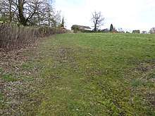
The site is private land with no public access. It has been filled in and no geology is visible.
References
- 1 2 3 4 "Designated Sites View: Wateringbury". Sites of Special Scientific Interest. Natural England. Retrieved 17 March 2018.
- ↑ "Map of Wateringbury". Sites of Special Scientific Interest. Natural England. Retrieved 17 March 2018.
- ↑ "Wateringbury (Quaternary of South-East England)". Geological Conservation Review. Joint Nature Conservation Committee. Archived from the original on 2018-01-12. Retrieved 12 January 2018.
- ↑ "Wateringbury citation" (PDF). Sites of Special Scientific Interest. Natural England. Retrieved 17 March 2018.
This article is issued from
Wikipedia.
The text is licensed under Creative Commons - Attribution - Sharealike.
Additional terms may apply for the media files.