Otterpool Quarry
| Site of Special Scientific Interest | |
 | |
| Area of Search | Kent |
|---|---|
| Grid reference | TR 112 364[1] |
| Interest | Geological |
| Area | 10.2 hectares (25 acres)[1] |
| Notification | 1984[1] |
| Location map | Magic Map |
Otterpool Quarry is a 10.2-hectare (25-acre) geological Site of Special Scientific Interest west of Hythe in Kent.[1][2] It is a Geological Conservation Review site.[3]
This quarry exposes rocks dating to the Cretaceous period, and shows the contact between the Hythe and Sandgate beds. It is very rich in fossil ammonites, with species which can be correlated elsewhere.[4]
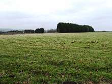
The site is private land with no public access. The quarry has been filled in and no geology is visible.
References
- 1 2 3 4 "Designated Sites View: Otterpool Quarry". Sites of Special Scientific Interest. Natural England. Retrieved 11 February 2018.
- ↑ "Map of Otterpool Quarry". Sites of Special Scientific Interest. Natural England. Retrieved 11 February 2018.
- ↑ "Otterpool Manor (Aptian-Albian)". Geological Conservation Review. Joint Nature Conservation Committee. Retrieved 11 January 2018.
- ↑ "Otterpool Quarry citation" (PDF). Sites of Special Scientific Interest. Natural England. Retrieved 11 February 2018.
| Wikimedia Commons has media related to Otterpool Quarry. |
This article is issued from
Wikipedia.
The text is licensed under Creative Commons - Attribution - Sharealike.
Additional terms may apply for the media files.