Otford to Shoreham Downs
| Site of Special Scientific Interest | |
 | |
| Area of Search | Kent |
|---|---|
| Grid reference | TQ 533 618[1] |
| Interest | Biological |
| Area | 145.1 hectares (359 acres)[1] |
| Notification | 1991[1] |
| Location map | Magic Map |
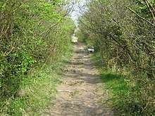
Otford to Shoreham Downs is a 145.1-hectare (359-acre) biological Site of Special Scientific Interest between Kemsing and Eynesford in Kent.[1][2] It is part of Kent Downs Area of Outstanding Natural Beauty[3] and part it is Fackenden Down, a nature reserve managed by the Kent Wildlife Trust[4]
These downs have woodland, scrub and species-rich chalk grassland, which has been traditionally managed by grazing. A decline in grazing has caused the chalk downland to become overgrown, but it is still very species diverse, with over a hundred plants recorded.[5]
References
- 1 2 3 4 "Designated Sites View: Otford to Shoreham Downs". Sites of Special Scientific Interest. Natural England. Retrieved 22 February 2018.
- ↑ "Map of Otford to Shoreham Downs". Sites of Special Scientific Interest. Natural England. Retrieved 22 February 2018.
- ↑ "Interactive Map". Kent Downs AONB. Retrieved 22 February 2018.
- ↑ "Fackenden Down". Kent Wildlife Trust. Archived from the original on 2018-01-03. Retrieved 18 January 2018.
- ↑ "Otford to Shoreham Downs citation" (PDF). Sites of Special Scientific Interest. Natural England. Retrieved 22 February 2018.
| Wikimedia Commons has media related to Otford to Shoreham Downs. |
This article is issued from
Wikipedia.
The text is licensed under Creative Commons - Attribution - Sharealike.
Additional terms may apply for the media files.