Wartburgkreis
| Wartburgkreis | ||
|---|---|---|
| District | ||
| ||
 | ||
| Country |
| |
| State | Thuringia | |
| Capital | Bad Salzungen | |
| Government | ||
| • District admin. | Reinhard Krebs (CDU) | |
| Area | ||
| • Total | 1,307.43 km2 (504.80 sq mi) | |
| Population (31 December 2017)[1] | ||
| • Total | 123,764 | |
| • Density | 95/km2 (250/sq mi) | |
| Time zone | UTC+01:00 (CET) | |
| • Summer (DST) | UTC+02:00 (CEST) | |
| Vehicle registration | WAK, SLZ | |
| Website | www.wartburgkreis.de | |
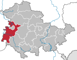
Wartburgkreis is a Kreis (district) in the west of Thuringia, Germany. Neighboring districts are (from the north clockwise) the districts Unstrut-Hainich, Gotha, Schmalkalden-Meiningen, and the districts Fulda, Hersfeld-Rotenburg and Werra-Meißner in Hesse. The district-free city Eisenach is nearly completely surrounded by the district.
History
The district was created in 1994 by merging the previous districts Eisenach and Bad Salzungen, and a few municipalities from the district Bad Langensalza. The city Eisenach left the district in 1998 and became a district-free city.
The district is named after the Wartburg, a castle near Eisenach most famous as the place of residence of Ludwig, Landgrave of Thuringia and his wife, Saint Elizabeth of Hungary; and, as Martin Luther's refuge in 1521.
Geography
The district is located in the Thuringian Forest, including the Hainich national park. The main river in the district is the Werra.
Coat of arms
 |
The coat of arms combines the symbols of the historic states which existed on the territory. In the topleft and the bottomright is the lion of the dukes of Thuringia, the fowl in the top right refers to the county Henneberg, and the black cross in the bottom left is the symbol of the imperial abbey and state of Fulda. |
Towns and municipalities
| Verwaltungsgemeinschaft-free towns | and municipalities | |
|---|---|---|
| Verwaltungsgemeinschaften | ||
|---|---|---|
|
|
|
| 1seat of the Verwaltungsgemeinschaft; 2town | ||
References
External links
- Official website (German)
| Urban districts | |
|---|---|
| Rural districts | |