Waldringfield Pit
| Site of Special Scientific Interest | |
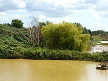 View towards Waldringfield Pit | |
| Area of Search | Suffolk |
|---|---|
| Grid reference | TM 260 448 [1] |
| Interest | Geological |
| Area | 0.8 hectares[1] |
| Notification | 1991[1] |
| Location map | Magic Map |
Waldringfield Pit is a 0.8 hectare geological Site of Special Scientific Interest between Martlesham Heath and Waldringfield in Suffolk.[1][2] It is a Geological Conservation Review site.[3]
This site exposes a sequence of Pleistocene deposits, with the early Red Crag overlain by Waldringfield Gravels, the lowest unit of the Kesgrave Sands and Gravels, which were deposits on the bed of the River Thames before it was diverted south by the Anglian Glaciation around 450,000 years ago. Waldringfield Pit is the type site for the Waldringfield Gravels.[4][5]
The site is private land with no public access.
References
- 1 2 3 4 "Designated Sites View: Waldringfield Pit". Sites of Special Scientific Interest. Natural England. Retrieved 20 August 2017.
- ↑ "Map of Waldringfield Pit". Sites of Special Scientific Interest. Natural England. Retrieved 20 August 2017.
- ↑ "Waldringfield (Quaternary of East Anglia)". Geological Conservation Review. Joint Nature Conservation Committee. Retrieved 20 August 2017.
- ↑ "Waldringfield Pit citation" (PDF). Sites of Special Scientific Interest. Natural England. Retrieved 20 August 2017.
- ↑ Bridgland, D. R. (1994). The Pleistocene of the Thames (PDF). London, UK: Chapman and Hall. p. 21. ISBN 0 41248 830 2.
This article is issued from
Wikipedia.
The text is licensed under Creative Commons - Attribution - Sharealike.
Additional terms may apply for the media files.