Neutral Farm Pit, Butley
| Site of Special Scientific Interest | |
 | |
| Area of Search | Suffolk |
|---|---|
| Grid reference | TM 371 510[1] |
| Interest | Geological |
| Area | 1.1 hectares[1] |
| Notification | 1985[1] |
| Location map | Magic Map |
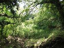
Neutral Farm Pit, Butley is a 1.1 hectare geological Site of Special Scientific Interest in Butley, east of Woodbridge in Suffolk.[1][2] It is a Geological Conservation Review site,[3] and is in the Suffolk Coast and Heaths Area of Outstanding Natural Beauty.[4]
This is described by Natural England as a classic site in the study of the Early Pleistocene in East Anglia. It was used by the nineteenth-century geologist Frederick W. Harmer to define his Butley division of the Red Crag Formation, and it has many fossils of marine molluscs.[5]
There is access to the site from Mill Lane.
References
- 1 2 3 4 "Designated Sites View: Neutral Farm Pit, Butley". Sites of Special Scientific Interest. Natural England. Retrieved 22 May 2017.
- ↑ "Map of Neutral Farm Pit, Butley". Sites of Special Scientific Interest. Natural England. Retrieved 22 May 2017.
- ↑ "Butley Neutral Farm Pit (Quaternary of East Anglia)". Geological Conservation Review. Joint Nature Conservation Committee. Retrieved 3 May 2017.
- ↑ "Suffolk Coast & Heaths Area of Outstanding Natural Beauty Management Plan 2013–2018" (PDF). Suffolk Coast & Heaths AONB. p. 76. Retrieved 6 August 2016.
- ↑ "Neutral Farm Pit, Butley citation" (PDF). Sites of Special Scientific Interest. Natural England. Retrieved 22 May 2017.
| Wikimedia Commons has media related to Neutral Farm Pit, Butley. |
This article is issued from
Wikipedia.
The text is licensed under Creative Commons - Attribution - Sharealike.
Additional terms may apply for the media files.