Sandy Lane Pit, Barham
| Site of Special Scientific Interest | |
 | |
| Area of Search | Suffolk |
|---|---|
| Grid reference | TM 135 515 [1] |
| Interest | Geological |
| Area | 11.1 hectares[1] |
| Notification | 1983[1] |
| Location map | Magic Map |
Sandy Lane Pit, Barham is an 11.1 hectare geological Site of Special Scientific Interest west of Barham in Suffolk.[1][2] It is a Geological Conservation Review site.[3]
This site has deposits which span the period from the Beestonian Stage, which ended around 866,000 years ago, through the warm Cromerian Stage to the severe ice age of the Anglian Stage, which started around 478,000 years ago. It has Beestonian deposits thought to have been laid down by the proto-Thames, and a paleosol, a former land surface dating to the Anglian.[4]
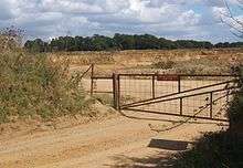
The site is private land with no public access.
References
- 1 2 3 4 "Designated Sites View: Sandy Lane Pit, Barham". Sites of Special Scientific Interest. Natural England. Retrieved 7 June 2017.
- ↑ "Map of Sandy Lane Pit, Barham". Sites of Special Scientific Interest. Natural England. Retrieved 7 June 2017.
- ↑ "Barham Sandy Lane Pit (Quaternary of East Anglia)". Geological Conservation Review. Joint Nature Conservation Committee. Retrieved 3 May 2017.
- ↑ "Sandy Lane Pit, Barham citation" (PDF). Sites of Special Scientific Interest. Natural England. Retrieved 7 June 2017.
This article is issued from
Wikipedia.
The text is licensed under Creative Commons - Attribution - Sharealike.
Additional terms may apply for the media files.