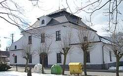
Vojnův Městec
| Vojnův Městec | |||
|---|---|---|---|
| Městys | |||
 | |||
| |||
 Vojnův Městec | |||
| Coordinates: 49°40′45″N 15°53′12″E / 49.67917°N 15.88667°ECoordinates: 49°40′45″N 15°53′12″E / 49.67917°N 15.88667°E | |||
| Country |
| ||
| Region | Vysočina | ||
| District | Žďár nad Sázavou | ||
| Area | |||
| • Total | 16.5 km2 (6.4 sq mi) | ||
| Elevation | 583 m (1,913 ft) | ||
| Population (1.1.2014) | |||
| • Total | 777 | ||
| • Density | 47/km2 (120/sq mi) | ||
| Postal code | 592 22 | ||
| Website | http://www.vojnuvmestec.cz/ | ||


Vojnův Městec is a market town (městys) in Žďár nad Sázavou District in the Vysočina Region of the Czech Republic.
The town covers an area of 16.5 square kilometres (6.4 sq mi), and has a population of 718 (as at 28 August 2006).
Vojnův Městec lies approximately 14 kilometres (9 mi) north of Žďár nad Sázavou, 38 km (24 mi) north-east of Jihlava, and 115 km (71 mi) south-east of Prague.
References
| Wikimedia Commons has media related to Vojnův Městec. |
This article is issued from
Wikipedia.
The text is licensed under Creative Commons - Attribution - Sharealike.
Additional terms may apply for the media files.