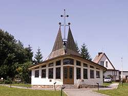
Škrdlovice
| Škrdlovice | |||
|---|---|---|---|
| Municipality | |||
 | |||
| |||
 Škrdlovice | |||
| Coordinates: 49°38′9″N 15°55′38″E / 49.63583°N 15.92722°ECoordinates: 49°38′9″N 15°55′38″E / 49.63583°N 15.92722°E | |||
| Country |
| ||
| Region | Vysočina | ||
| District | Žďár nad Sázavou | ||
| Area | |||
| • Total | 5.74 km2 (2.22 sq mi) | ||
| Elevation | 645 m (2,116 ft) | ||
| Population (1.1.2014) | |||
| • Total | 655 | ||
| • Density | 110/km2 (300/sq mi) | ||
| Postal code | 592 21 | ||
| Website | http://www.skrdlovice.cz/ | ||


Škrdlovice is a village and municipality (obec) in Žďár nad Sázavou District in the Vysočina Region of the Czech Republic.
The municipality covers an area of 5.74 square kilometres (2.22 sq mi), and has a population of 624 (as at 3 July 2006).
Škrdlovice lies approximately 8 kilometres (5 mi) north of Žďár nad Sázavou, 37 km (23 mi) north-east of Jihlava, and 120 km (75 mi) south-east of Prague.
References
| Wikimedia Commons has media related to Škrdlovice. |
This article is issued from
Wikipedia.
The text is licensed under Creative Commons - Attribution - Sharealike.
Additional terms may apply for the media files.