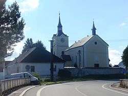
Ostrov nad Oslavou
| Ostrov nad Oslavou | |||
|---|---|---|---|
| Městys | |||
 | |||
| |||
 Ostrov nad Oslavou | |||
| Coordinates: 49°29′13″N 15°59′8″E / 49.48694°N 15.98556°ECoordinates: 49°29′13″N 15°59′8″E / 49.48694°N 15.98556°E | |||
| Country |
| ||
| Region | Vysočina | ||
| District | Žďár nad Sázavou | ||
| Area | |||
| • Total | 9.33 km2 (3.60 sq mi) | ||
| Elevation | 520 m (1,710 ft) | ||
| Population (1.1.2013) | |||
| • Total | 960 | ||
| • Density | 100/km2 (270/sq mi) | ||
| Postal code | 594 45 | ||
| Website | http://www.ostrovno.cz | ||


Ostrov nad Oslavou is a market town (městys) in Žďár nad Sázavou District in the Vysočina Region of the Czech Republic.
The town covers an area of 9.33 square kilometres (3.60 sq mi), and has a population of 892 (as at 28 August 2006).
Ostrov nad Oslavou lies on the Oslava River, approximately 10 kilometres (6 mi) south of Žďár nad Sázavou, 31 km (19 mi) east of Jihlava, and 131 km (81 mi) south-east of Prague.
References
| Wikimedia Commons has media related to Ostrov nad Oslavou. |
This article is issued from
Wikipedia.
The text is licensed under Creative Commons - Attribution - Sharealike.
Additional terms may apply for the media files.