Venetian Works of Defence between the 16th and 17th centuries: Stato da Terra – western Stato da Mar
| UNESCO World Heritage site | |
|---|---|
| Location | |
| Criteria | Cultural: (iii), (iv) |
| Reference | 1533 |
| Inscription | 2017 (41st Session) |
| Area | 378.37 ha (935.0 acres) |
| Buffer zone | 1,749.62 ha (4,323.4 acres) |
| Coordinates | 45°42′12″N 9°39′49″E / 45.70333°N 9.66361°ECoordinates: 45°42′12″N 9°39′49″E / 45.70333°N 9.66361°E |
 Location of Venetian Works of Defence between the 16th and 17th centuries: Stato da Terra – western Stato da Mar in Earth | |
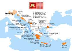
Venetian Works of Defence between the 16th and 17th centuries: Stato da Terra – western Stato da Mar is the official denomination given by UNESCO to six defensive walls built by the Republic of Venice on its mainland domains (Stato da Terra) and its Domains of the Sea (Stato da Mar).
Properties
| Site | Image | Location |
|---|---|---|
| Fortified City of Bergamo | 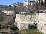 |
Lombardy, Italy 45°42′12″N 9°39′49″E / 45.70333°N 9.66361°E |
| Fortified City of Peschiera del Garda | .jpg) |
Veneto, Italy 45°26′20″N 10°41′39″E / 45.43889°N 10.69417°E |
| City Fortress of Palmanova | 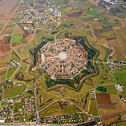 |
Friuli-Venezia Giulia, Italy 45°54′22″N 13°18′35″E / 45.90611°N 13.30972°E |
| Defensive System of Zadar | 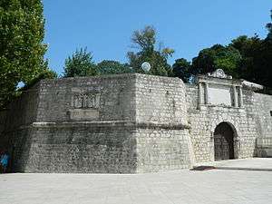 |
Zadar County, Croatia 44°6′42″N 15°13′49″E / 44.11167°N 15.23028°E |
| Fort of St. Nikola, Šibenik-Knin County | 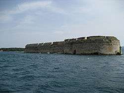 |
Šibenik-Knin County, Croatia 43°43′17″N 15°51′17″E / 43.72139°N 15.85472°E |
| Fortified City of Kotor | 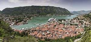 |
Kotor Municipality, Montenegro 42°25′25″N 18°46′19″E / 42.42361°N 18.77194°E |
References

| ||
This article is issued from
Wikipedia.
The text is licensed under Creative Commons - Attribution - Sharealike.
Additional terms may apply for the media files.