Kotor Municipality
| Kotor Municipality Opština Kotor Општина Котор | ||
|---|---|---|
| Municipality | ||
| ||
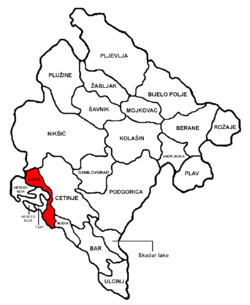 Kotor Municipality in Montenegro | ||
| Coordinates: 42°26′00″N 18°46′00″E / 42.4333°N 18.7667°ECoordinates: 42°26′00″N 18°46′00″E / 42.4333°N 18.7667°E | ||
| Country |
| |
| Seat | Kotor | |
| Area[1] | ||
| • Total | 335 km2 (129 sq mi) | |
| Population | ||
| • Total | 22,601 | |
| • Density | 67/km2 (170/sq mi) | |
| Area code(s) | +382 32 | |
| Vehicle registration | KO | |
| Website |
www | |

Kotor Municipality (Montenegrin: Opština Kotor/Општина Котор) is one of the municipalities of Montenegro. Its administrative center is Kotor. This municipality is located in the southwest part of Montenegro, and includes 56 recognized settlements[2] as well as the innermost portion of the Bay of Kotor.
Demographics
2011 census
The 2011 census recorded a total population of 22,601[3]. The inhabitants included Montenegrins, numbering 11,047 (48.88%); Serbs, numbering 6,910 (30.57%); Croats, numbering 1,553 (6.87%); with the rest belonging to other ethnic groups (1,145, 5.07%) or opting undeclared (1,946, 8.61%). By language, 38.46% spoke Montenegrin, while 42.37% spoke Serbian. Major religious affiliations included Eastern Orthodoxy (78.02%) and Roman Catholicism (11.76%).
References
- ↑ http://database.uom.me/municipal_profile_en.aspx?ID=59
- ↑ Census 2011 data - Settlements, Statistical Office of Montenegro
- ↑ http://www.monstat.org/userfiles/file/popis2011/saopstenje/saopstenje%281%29.pdf