U.S. Route 11 in Tennessee
| ||||
|---|---|---|---|---|
| Route information | ||||
| Maintained by TDOT | ||||
| Length | 124.86 mi (200.94 km) | |||
| Existed | 1920s–present | |||
| Major junctions | ||||
| South end |
| |||
| North end |
| |||
| Location | ||||
| Counties | Hamilton, Bradley, McMinn, Monroe, Loudon, Knox, Sevier, Jefferson | |||
| Highway system | ||||
| ||||

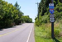
U.S. Route 11 (US 11) in the U.S. state of Tennessee travels from the Georgia state line in Chattanooga to Knoxville, where it then splits into US 11E and US 11W. These two highways then travel to the Virginia state line near Kingsport and Bristol. During its length, it shares concurrencies with SR 2 and SR 38.
Route description
US 11 enters Tennessee west of Chattanooga. The route, concurrent with SR 38 from the state line north, runs parallel to Interstate 24 for three miles (5 km) to an intersection with Cummings Highway (US 41/US 64/US 72/SR 2). While SR 38 terminates here, US 11 follows the highway east into downtown Chattanooga. At the intersection of Broad Street and East 23rd Street, US 11 and US 64 separate from US 41 and US 72 and follow East 23rd east through downtown. The routes briefly overlap with US 41, here concurrent to US 76, on Dodds Avenue before resuming an easterly progression on Brainerd Road thereafter called Lee Highway.[1]
East of downtown, I-24 terminates while Interstate 75 continues east along the I-24 right-of-way. US 11 and US 64 continue to the northeast, through northern Chattanooga, and run concurrent with I-75 between exits 7 and 11. State Route 317 runs concurrent with I-75 between exits 7 and 9. At exit 11, the route splits, running through Ooltewah and Collegedale before entering Bradley County. The route travels north to Cleveland and comes to an interchange with APD-40 (US 64 Bypass/US 74/SR 311). In downtown Cleveland, US 64 separates from US 11, following State Route 40 east out of the city.[1]
US 11 parallels I-75 as it heads north, passing through Athens, where it intersects with SR 30 Sweetwater, where it intersects SR 68, Loudon, where it intersects SR 72, and Lenoir City where it intersects with US 321/SR 95. The route then forms a concurrency with US 70 (Kingston Pike) at Dixie Lee Junction and enters Knox County passing first through Farragut and then entering West Knoxville. The route comes to an intersection with SR 131 and then Interstate 140. In downtown Knoxville, the routes intersect with US 129 and US 441. US 11 and US 70 split east of Knoxville, and split into US 11 E and US 11 W. US 11 E goes through Rutledge, Bean Station, Rogersville, and Kingsport. US 11 W goes through Jefferson City, Morristown, Russellville, Greeneville, Jonesborough, Johnson City, where the route forms a concurrency with US 19, and Bristol, before crossing into Virginia.[1]
Major intersections
| County | Location | mi | km | Destinations | Notes |
|---|---|---|---|---|---|
| Hamilton | | 0.0 | 0.0 | Continuation into Georgia; southern terminus of unsigned SR 38 | |
| | Southern end of US 41/US 64/US 72/SR 2 concurrency; northern terminus of SR 38 | ||||
| | |||||
| | |||||
| Chattanooga | Southern end of SR 17 concurrency | ||||
| Northbound exit and southbound entrance | |||||
| Eastern end of US 41 / US 72 concurrency; western end of SR 58 concurrency | |||||
| Eastern end of SR 58 concurrency | |||||
| Direct access only from northbound I-24; I-24 exit 180A | |||||
| Southern end of US 41 / US 76 concurrency | |||||
| Northern end of US 41 / US 76 concurrency | |||||
| McCallie Tunnels under Missionary Ridge | |||||
| SR 153 exit 1 | |||||
| Southern end of SR 317 concurrency | |||||
| Southern end of I-75 / US 74 concurrency; I-75 exit 7 | |||||
| Northern end of SR 317 concurrency; I-75 exit 9 | |||||
| Ooltewah | Eastern end of I-75 / US 74 concurrency; I-75 exit 11 | ||||
| Bradley | Cleveland | Interchange on US 64 Bypass (APD-40) | |||
| Southern end of US 11 Bypass | |||||
| Western terminus of US 64 concurrency; eastern terminus of SR 312 | |||||
| Northern terminus of US 11 Bypass and SR 74 (concurrency) | |||||
| Paul Huff Parkway | Eastern terminus of Paul Huff Parkway | ||||
| Charleston | Eastern terminus of SR 308 | ||||
| Hiwassee River | Bridge over the Hiwassee River | ||||
| McMinn | Calhoun | Southern end of SR 163 concurrency | |||
| Northern end of SR 163 concurrency | |||||
| Riceville | Southern end of SR 39 concurrency; southern terminus of US 11 Business | ||||
| Northern end of SR 39 concurrency | |||||
| Athens | West to I-75 | ||||
| Northern terminus of US 11 Business | |||||
| West to I-75 | |||||
| Niota | Eastern terminus of SR 309 | ||||
| Monroe | Sweetwater | West to I-75 | |||
| Loudon | Philadelphia | Eastern terminus of SR 323 | |||
| Loudon | |||||
| Congressman John J. Duncan Jr. Loudon County Veterans Memorial Bridge over the Tennessee River | |||||
| Eastern terminus of SR 324 | |||||
| Lenoir City | |||||
| Dixie Lee Junction | Eastern terminus of SR 2; southern end of US 70/SR 1 concurrency | ||||
| Knox | Farragut | Northwestern terminus of SR 332 | |||
| Knoxville | |||||
| I-140 Exit 1 | |||||
| Northeastern terminus of SR 332 | |||||
| Cumberland Avenue (former US 11 / US 70 / SR 1) to US 441 - Downtown Knoxville | Western end of unsigned SR 158 concurrency | ||||
| Joe Johnson Boulevard – University of Tennessee | |||||
| Lake Loudon Boulevard – University of Tennessee | |||||
| Walnut Street – Civic Colesium / Blount Mansion / James White Fort | Intersection with exit to Tennessee Riverboat Landing | ||||
| Volunteer Landing | Eastbound exit only | ||||
| Eastbound exit, westbound entrance; eastern end of SR 158 concurrency; unsigned to SR 71 | |||||
| Summit Hill Drive | To US 441/SR 62 | ||||
| East 5th Avenue / Hall of Fame Drive | |||||
| Route splits into US 11E and US 11W; US 70/SR 1 continues along US 11E; eastern terminus of unsigned SR 168 | |||||
1.000 mi = 1.609 km; 1.000 km = 0.621 mi
| |||||
See also


- Special routes of U.S. Route 11
References
| Wikimedia Commons has media related to U.S. Route 11 in Tennessee. |
- 1 2 3 Official Transportation Map (back) (PDF) (Map). TDOT. 2016. Archived from the original (PDF) on July 25, 2016. Retrieved November 1, 2017.