U.S. Route 129 in Tennessee
| |||||||
|---|---|---|---|---|---|---|---|
| Route information | |||||||
| Maintained by TDOT | |||||||
| Length | 53 mi[1] (85 km) | ||||||
| Existed | 1934–present | ||||||
| Major junctions | |||||||
| South end |
| ||||||
|
| |||||||
| North end |
| ||||||
| Location | |||||||
| Counties | Blount, Monroe, Knox | ||||||
| Highway system | |||||||
| |||||||

U.S. Route 129 (US 129) is a north–south United States highway that runs for 52.8 miles (85.0 km) in East Tennessee, from the North Carolina state line, near Tapoco, to Knoxville. In Tennessee, the highway is completely overlapped by unsigned State Route 115 (SR 115).
Route description
US 129 enters Tennessee through Deals Gap, where it twists and turns along the Little Tennessee River. This section is known as "The Dragon", popular to driving enthusiasts (of motorcycles and sports cars). At Clover Hill, US-129 joins US 411 to Maryville; from this point US 129 continues on as a 4-lane highway/expressway. Bypassing east around Maryville and Alcoa, it connects with Pellissippi Parkway (I-140) before entering Knoxville, where it ends at I-40. Tennessee State Route 115 (SR 115) is the hidden state route that overlaps the entire route. That is 49 miles (78 km) long. It begins in Blount County and ends in Knox County.
Counties traversed (east to west) in Tennessee
State Route 115 traverses the counties shown in the table below.
| Counties traversed by State Route 115 | ||
|---|---|---|
| County | miles | kilometers |
| Blount | 20.5 | 33.0 |
| Monroe | 1.1 | 1.7 |
| Blount | 20.4 | 32.8 |
| Knox | 6.7 | 10.7 |
History
Junction list
| County | Location | mi[1] | km | Destinations | Notes |
|---|---|---|---|---|---|
| Blount | | 0.0 | 0.0 | Continuation from North Carolina through Deals Gap; south end of SR 115 overlap | |
| Chilhowee | 14.3 | 23.0 | Foothills Parkway | Southern terminus of Foothills Parkway | |
| Monroe | Pumpkin Center | 21.4 | 34.4 | Eastern terminus of SR 72 | |
| Blount | | 25.0 | 40.2 | ||
| Clover Hill | 32.0 | 51.5 | South end of US 411/SR 33 overlap | ||
| Maryville | 33.8 | 54.4 | Southern terminus of SR 335 | ||
| 36.3 | 58.4 | North end of US 411/SR 33 concurrency; Interchange; northbound to northbound, southbound to southbound, and southbound US 411/SR 33 to northbound US 129; access from southbound US 129 to northbound US 411/SR 33 via U-turn at Cooper Street | |||
| 36.8 | 59.2 | Mall Road | Southbound right-in/right-out ramps | ||
| 37.2 | 59.9 | ||||
| 37.8 | 60.8 | SR 446 is unsigned; northern terminus of SR 446 | |||
| Alcoa | 38.2 | 61.5 | West Bessemer Street / Middlesettlements Road | Diverging diamond interchange | |
| 40.0 | 64.4 | Interchange; northbound to northbound, southbound to southbound, and northbound US 129 to southbound SR 35 Access from northbound SR 35 to southbound US 129 via U-turn on northbound US 129 at milepost 40.2 | |||
| 40.7 | 65.5 | Interchange There is an additional ramp from East Hunt Road westbound to northbound US 129 | |||
| 41.2 | 66.3 | Interchange | |||
| 43.1 | 69.4 | ||||
| 43.4 | 69.8 | Cloverleaf interchange; exits 11A-B (I-140) | |||
| 45.8 | 73.7 | Northern terminus of SR 333 | |||
| Knox | Knoxville | 47.0 | 75.6 | Interchange; northbound lanes of US 129 grade-separated from SR 168 with an exit and an entrance ramp; southbound US 129 has a left exit and a left entrance - the southbound ramps cross each other at an at-grade intersection controlled by a stop sign on the entrance ramp | |
| 50.8 | 81.8 | Cherokee Trail – UT Medical Center | Trumpet interchange | ||
| 51.2– 51.5 | 82.4– 82.9 | UT Cherokee Farm campus site / UTMC | Northbound, one right-in/right-out driveway, one entrance ramp; southbound, two right-in/right-out driveways | ||
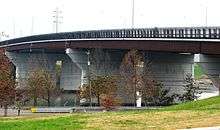
| 51.5 | 82.9 | J. E. "Buck" Karnes Bridge over the Tennessee River | |||
| 51.8 | 83.4 | Interchange; no access to southbound US 129 | |||
| 51.9 | 83.5 | Interchange | |||
| 52.8 | 85.0 | US 129 ends; north end of SR 115 overlap Semi-directional T interchange; exit 386B (I-40) Ramp to SR 62 splits from ramp to I-40 east, providing access via Dale Avenue NW Access from | |||
1.000 mi = 1.609 km; 1.000 km = 0.621 mi
| |||||
See also
References
- 1 2 Google (2011-02-28). "US 129" (Map). Google Maps. Google. Retrieved 2011-02-28.
- Tennessee Department of Transportation (24 January 2003). "State Highway and Interstate List 2003".
External links

- Tennessee Department of Transportation
| Previous state: North Carolina |
Tennessee | Next state: Terminus |