Paul Huff Parkway
| Maintained by | TDOT |
|---|---|
| Length | 2.4 mi[1] (3.9 km) |
| West end |
|
| Major junctions |
|
| East end |
|
| Construction | |
| Construction start | 1986 |
| Completion | 1990 |
The C.S.M. Paul B. Huff Medal of Honor Memorial Parkway, more commonly known as Paul B. Huff Parkway or Paul Huff Parkway, is a major east–west thoroughfare which runs through northern Cleveland, Tennessee. While not a numbered highway, it serves as a connector between U.S. Route 11 (US 11) and State Route 60 (SR 60) as well as to Interstate 75 (I-75), is maintained by the Tennessee Department of Transportation (TDOT), and has come to be one of the most heavily traveled and widely used roads in the city, with many corporate and private businesses locating to it.[2] The road is named in honor of Paul B. Huff, a Cleveland-born recipient of the Medal of Honor for his actions in World War II.
Route description
Paul Huff Parkway begins at an intersection with SR 60 (Georgetown Road) in the northwestern part of the city. An unofficial extension of the road exists approximately 1⁄8 mile (0.20 km) west of the intersection. It then immediately crosses Candies Creek Ridge as an undivided four-lane road. After crossing the ridge it comes to an intersection with Frontage Road/Adkisson Drive, where a center (turn) lane begins. Adkisson connects to Cleveland State Community College. About 0.2 miles (0.32 km) later the road comes to an interchange with I-75. Afterwards the road enters a large corporate and business area coming to an intersection with Peerless Road, and then Mouse Creek Road approximately 0.25 miles (0.40 km) later, an alternate route to Charleston. The road then passes by E.L. Ross Elementary School and a shopping center on the opposite side of the road, coming to an intersection with Freedom Parkway approximately 0.1 miles (0.16 km) later. The road then passes a fire and ambulance station and crosses South Mouse Creek and the Cleveland/Bradley County Greenway. Ascending to the top of a minor ridge the road comes to an intersection with an untitled connector road to the Bradley Square Mall and Hickory Grove Shopping Center and Walmart on the opposite side of the road. Approximately 0.25 miles (0.40 km) later the road comes to an intersection with US 11/SR 2, where it ends and continues east as Stuart Road.[1][3]
History
The road was first planned a connector road between the interstate and industrial parks on the northeastern part of the city. A project that preceded the Parkway was the construction of Stuart Road between North Lee Highway and Urbane Road/Old Tasso Road in the mid 1970s, and the extension to Dry Valley Road/Michigan Avenue Road in 1982. Many residents in the area were opposed to the Parkway's construction, as they felt it would bring unwanted commercial development, which it eventually did.
The first section, between Mouse Creek Road and Adkisson Drive/Frontage Road was built between 1986 and 1987. Part of this section replaced a two lane road that ran from the Adkisson Drive/Frontage Road intersection under I-75 to what is now the intersection with Peerless Road.[4] At the same time, the interchange with I-75 was built. The Parkway was extended to North Lee Highway beginning in 1987, and was opened and dedicated in honor of Sgt. Paul B. Huff on Veterans Day, November 11, 1988.[5][6] Between late 1988 and 1990 the road was extended over Candies Creek Ridge. This project was very laborious, requiring work crews to blast out and move tons of earth and rock, and stabilize the sides of the ridge between the road,[7] and was not initially planned.
Following the opening of the Bradley Square Mall in 1991, the Parkway saw a boom of commercial development from the late 1990s to the mid 2000s.[8] These included several strip malls including the Hickory Grove Shopping Center as well as such stores as Lowe's, The Home Depot, Publix, and several restaurants and hotels.[1]
In 2015, a short extension of the road was constructed west of SR 60.[9] The speed limit was reduced from 50 to 45 miles per hour in early 2016 after a long history of motorists alleging that the 50 mph limit, which was nearly impossible to drive on most of the parkway because of constant stop-and-go traffic, misled many drivers of the conditions of the road and encouraged reckless driving. A short segment of State Route 374 in Clarksville, Tennessee, is also known as the Paul B. Huff Memorial Parkway.[10]
Gallery
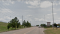 Paul Huff Parkway near Bradley Square Mall.
 Sign on I-75 southbound.
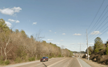 Paul Huff Parkway crossing Candies Creek Ridge.
Major intersections
The entire route is in Cleveland, Bradley County.
| mi[1] | km | Destinations | Notes | ||
|---|---|---|---|---|---|
| 0.00 | 0.00 | Continues west to a dead end | |||
| 0.90 | 1.45 | Diamond interchange; exit 27 on I-75 | |||
| 2.40 | 3.86 | Continues east as Stuart Road | |||
| 1.000 mi = 1.609 km; 1.000 km = 0.621 mi | |||||
See also


- APD-40
- U.S. Route 11 Bypass (Cleveland, Tennessee)
References
- 1 2 3 4 Google (November 26, 2017). "Paul Huff Parkway" (Map). Google Maps. Google. Retrieved November 26, 2017.
- ↑ Exit Explorer
- ↑ City Limits Map (Map). Cleveland Chamber of Commerce. 2013. Retrieved July 7, 2014.
- ↑ East Cleveland, Tennessee (Map). US Geological Survey. 1976. Retrieved November 13, 2017.
- ↑ "Command Sergeant Major (Retired) Paul B. Huff". 509thgeronimo.com. 509th Infantry Regiment. 2006. Retrieved November 3, 2017.
- ↑ Guthrie, Chet (July 23, 2015). "Busy street once site of the Guthrie farm". Cleveland Daily Banner. Cleveland, Tennessee. Retrieved 2018-07-05.
- ↑ Graves, Brian (February 10, 2016). "Bradley Square Mall turns 25". Cleveland Daily Banner. November 3, 2017. Retrieved November 13, 2017.
- ↑ Leach, Paul (August 25, 2015). "Cleveland hits brakes on Paul Huff Parkway extension". Chattanooga Times Free Press. Retrieved November 3, 2017.
- ↑ Erwin, Chris (November 4, 2014). Camping Kentucky: A Comprehensive Guide to Public Tent and RV Campgrounds. Lanham, Maryland: Rowman & Littlefield. p. 146. ISBN 9780762787999.