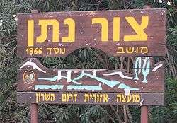
Tzur Natan
| Tzur Natan צוּר נָתָן | |
|---|---|
 | |
 Tzur Natan | |
| Coordinates: 32°14′24.72″N 35°0′42.11″E / 32.2402000°N 35.0116972°ECoordinates: 32°14′24.72″N 35°0′42.11″E / 32.2402000°N 35.0116972°E | |
| District | Central |
| Council | Drom HaSharon |
| Affiliation | Mishkei Herut Beitar |
| Founded | 1966 |
| Founded by | Nahal |
| Population (2017)[1] | 310 |
Tzur Natan (Hebrew: צוּר נָתָן, lit. Rock of Nathan) is a Moshav shitufi in central Israel. Located in western Samaria on a hilltop, 170 m above sea level, on a ridge in the foothills of the Samaritan Hills and to the south of Tayibe,[2][3] it falls under the jurisdiction of Drom HaSharon Regional Council. In 2017 it had a population of 310.[1]
History
The moshav was founded in 1966 as a Nahal settlement by Hashomer Hatzair members, and was named after Nathan Simons. It was civilianised a year later by former members of the Beitar youth group.
In 2017, a minority of Tzur Natan families agreed to sell their land to a natural gas and diesel power station to be constructed by Edeltech only meters from the Arab Israeli city of Tira.
References
- 1 2 "List of localities, in Alphabetical order" (PDF). Israel Central Bureau of Statistics. Retrieved August 26, 2018.
- ↑ Zur Natan - Final Report
- ↑ Introduction to the Excavations at Zur Natan, E. Ayalon, E. Matthews, W. Neidinger, Texas foundation for Archaeological and Historical Research, 1994
This article is issued from
Wikipedia.
The text is licensed under Creative Commons - Attribution - Sharealike.
Additional terms may apply for the media files.