Town Kelloe Bank
| Town Kelloe Bank | |
| Site of Special Scientific Interest | |
| Country | England |
|---|---|
| Region | North East |
| District | County Durham |
| Location | NZ359373 |
| - coordinates | 54°43′47″N 1°26′36″W / 54.72972°N 1.44333°WCoordinates: 54°43′47″N 1°26′36″W / 54.72972°N 1.44333°W |
| Area | 6.0 ha (14.8 acres) |
| Notification | 1976 |
| Management | Natural England |
| Area of Search | County Durham |
| Interest | Biological |
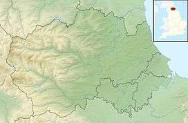 Location of Town Kelloe Bank SSSI, Co Durham | |
| Website: Map of site | |
Town Kelloe Bank is a Site of Special Scientific Interest in County Durham, England. It is situated to the south of The Bottoms SSSI and just north of the village of Town Kelloe.
The site has an important expanse of primary magnesian limestone grassland, in which the dominant blue moor-grass, Sesleria albicans, is associated with species such as quaking grass, Briza media, glaucous sedge, Carex flacca, and meadow oat-grass, Avenula pratensis.[1]
The site holds the largest known population of bird's-eye primrose, Primula farinosa, in County Durham. Other plants that are largely confined to northern limestone areas include butterwort, Pinguicula vulgaris, maidenhair spleenwort, Asplenium trichomanes, and grass of Parnassus, Parnassia palustris.
The site has a breeding population of the Durham argus butterfly, Aricia artaxerxes salmacis.[1]
References
- 1 2 "Town Kelloe Bank" (PDF). English Nature. 1983. Retrieved 2 August 2010.