Low Redford Meadows
| Low Redford Meadows | |
| Site of Special Scientific Interest | |
| Country | England |
|---|---|
| Region | North East |
| District | Teesdale |
| Location | NZ077309 NZ084309 |
| - coordinates | 54°40′25″N 1°52′33″W / 54.67361°N 1.87583°WCoordinates: 54°40′25″N 1°52′33″W / 54.67361°N 1.87583°W |
| Area | 9.3 ha (23.0 acres) |
| Notification | 1991 |
| Management | Natural England |
| Area of Search | County Durham |
| Interest | Biological |
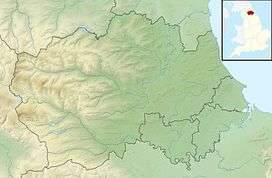 Location of Low Redford Meadows SSSI, Co Durham | |
| Website: Map of site | |
Low Redford Meadows is a Site of Special Scientific Interest in the Teesdale district of County Durham, England. It consists of two separate areas of meadows, situated in the floodplain and on the valley slopes of Bedburn Beck, 2 km upstream from the village of Bedburn. Like Frog Wood Bog SSSI, a short distance upstream, the meadows lie within the confines of Hamsterley Forest.
The site is important as preserving a rich assemblage of plant species, in a habitat that is becoming increasingly scarcer as a result of intensive agricultural practices. A wide variety of flowering plants is found, with some, such as wood cranesbill, Geranium sylvaticum, great burnet, Sanguisorba officinalis, and cat's ear, Hypochaeris radicata, present in such abundance as to be locally dominant in different fields.[1]
References
- ↑ "Low Redford Meadows" (PDF). English Nature. 1991. Retrieved 23 July 2010.