Brignall Banks
| Brignall Banks | |
| Site of Special Scientific Interest | |
| Country | England |
|---|---|
| Region | North East |
| District | Teesdale |
| Location | NZ063113 |
| - coordinates | 54°29′51″N 1°54′12″W / 54.49750°N 1.90333°WCoordinates: 54°29′51″N 1°54′12″W / 54.49750°N 1.90333°W |
| Area | 85.0 ha (210.0 acres) |
| Notification | 1987 |
| Management | Natural England |
| Area of Search | County Durham |
| Interest | Biological |
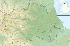 Location of Brignall Banks SSSI, Co Durham | |
| Website: Map of site | |
Brignall Banks is a Site of Special Scientific Interest in the Teesdale district of south-west County Durham, England. It consists of a narrow belt of woodland on the steep slopes of the valleys of the River Greta and its tributary, Gill Beck, just west of the village of Brignall and about 6 km south of Barnard Castle.
It is one of the largest expanses of semi-natural woodland in North-east England; a number of scarce species are present, indicating that it is ancient woodland.[1]
A varied lichen flora includes several species that are sensitive to air pollution and rare in County Durham, including some, such as Thelotrema lepadinum and Graphis scripta, that are indicator species for ancient woodland.
References
- ↑ "Brignall Banks" (PDF). English Nature. 1985. Retrieved 18 July 2010.
This article is issued from
Wikipedia.
The text is licensed under Creative Commons - Attribution - Sharealike.
Additional terms may apply for the media files.