Cassop Vale
| Cassop Vale | |
| Site of Special Scientific Interest | |
 Cassop Vale | |
| Country | England |
|---|---|
| Region | North East |
| District | Durham City |
| Location | NZ335387 |
| - coordinates | 54°44′33.4″N 1°28′49.4″W / 54.742611°N 1.480389°WCoordinates: 54°44′33.4″N 1°28′49.4″W / 54.742611°N 1.480389°W |
| Area | 40.9 ha (101.1 acres) |
| Notification | 1958 |
| Management | Natural England |
| Area of Search | County Durham |
| Interest | Biological |
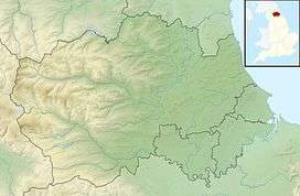 Location of Cassop Vale SSSI, Co Durham | |
| Website: Map of site | |
Cassop Vale is a Site of Special Scientific Interest in the Durham City district of County Durham, England. It lies between the villages of Bowburn and Cassop, 7 km south-east of the centre of Durham..
The site is important as one of the larger areas of grassland developed on magnesium limestone. This rock has a restricted distribution in England and grassland associated with it is confined almost entirely to south-east Tyneside and County Durham, usually in small, scattered patches that are threatened by quarrying and modern agricultural practices.[1]
Habitats at Cassop Vale include grassland, scrub, woodland and wetland, the last fed by spring-lines. The area also includes recolonised open quarries and mine spoil-heaps, which add to the floral diversity. Several rare and local species are present, including globeflower, Trollius europaeus, birds's-eye primrose, Primula farinosa, lesser club-moss, Selaginella selaginoides, and moonwort, Botrychium lunaria. The area also supports a diverse invertebrate fauna that includes populations of the Durham Argus butterfly, Aricia artaxerxes salmacis.[1]
References
- 1 2 "Cassop Vale" (PDF). English Nature. 1985. Retrieved 18 July 2010.