Far High House Meadows
| Far High House Meadows | |
| Site of Special Scientific Interest | |
| Country | England |
|---|---|
| Region | North East |
| District | Wear Valley |
| Location | NY839383 |
| - coordinates | 54°44′23″N 2°15′3″W / 54.73972°N 2.25083°WCoordinates: 54°44′23″N 2°15′3″W / 54.73972°N 2.25083°W |
| Area | 5.5 ha (13.6 acres) |
| Notification | 1990 |
| Management | Natural England |
| Area of Search | County Durham |
| Interest | Biological |
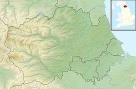 Location of Far High House Meadows SSSI, Co Durham | |
| Website: Map of site | |
Far High House Meadows is a Site of Special Scientific Interest in Upper Weardale in west County Durham, England. It consists of three fields, located just south of Burnhope Reservoir, some 3 km west of the village of Ireshopeburn. Two of the fields are maintained as northern hay meadows by traditional farming methods, without re-seeding or the application of artificial fertilisers; the third is grazed as pasture.
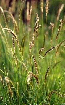
The hay fields are dominated by common bent, Agrostis capillaris, and sweet vernal-grass, Anthoxanthum odoratum, and support a diversity of forbs, among which globe-flower, Trollius europaeus, and marsh-marigold, Caltha palustris, are well represented, with early-purple orchid, Orchis mascula, among the species present in the wetter areas.
The pasture is a mix of acidic upland grassland, dry grassland and flushes, the last dominated by rushes and sedges.[1]
References
- ↑ "Far High House Meadows" (PDF). English Nature. 1990. Archived from the original (PDF) on 22 June 2011. Retrieved 19 July 2010.