Tilatá Formation
| Tilatá Formation Stratigraphic range: Late Miocene-Late Pliocene ~5.3–2.7 Ma | |
|---|---|
| Type | Geological formation |
| Sub-units | Tequendama Mb., Tibagota Mb., Guasca Mb. |
| Underlies | Subachoque Formation |
| Overlies |
Guadalupe Gp. Guaduas Fm., Cacho Fm., Bogotá Fm., Regadera Fm. |
| Thickness | up to 83 m (272 ft) |
| Lithology | |
| Primary | Conglomerate, sandstone |
| Other | Shale |
| Location | |
| Coordinates | 5°05′56.9″N 73°42′49.7″W / 5.099139°N 73.713806°WCoordinates: 5°05′56.9″N 73°42′49.7″W / 5.099139°N 73.713806°W |
| Region |
Bogotá savanna, Altiplano Cundiboyacense Eastern Ranges, Andes |
| Country |
|
| Type section | |
| Named for | Hacienta Tilatá |
| Named by | Scheibe |
| Location | Chocontá |
| Year defined | 1933 |
| Coordinates | 5°05′56.9″N 73°42′49.7″W / 5.099139°N 73.713806°W |
| Region | Cundinamarca |
| Country |
|
The Tilatá Formation (Spanish: Formación Tilatá, N1t, Tpt) is a geological formation of the Bogotá savanna, Altiplano Cundiboyacense, Eastern Ranges of the Colombian Andes. The formation consists of coarse to very coarse conglomerates and sandstones. The Tilatá Formation dates to the Neogene period; Late Miocene to Late Pliocene epochs (from approximately 5.3 to 2.7 Ma), and has a maximum thickness of 83 metres (272 ft). The formation underlies the Quaternary sequence of alluvial, lacustrine and fluvial sediments of Lake Humboldt.
Etymology
The formation was first defined and named by Scheibe in 1933 after the Hacienda Tilatá in Chocontá, near the Sisga Reservoir. Hubach (1957) elevated the Pisos de Tilatá to a formation.[1]
Description
Lithologies
The Tilatá Formation consists of medium to coarse grained sandstones and conglomerates with minor shale beds.[1]
Stratigraphy and depositional environment
The Tilatá Formation is the lowermost of the lacustrine and alluvial sequence of the Bogotá savanna. It unconformably overlies the Cretaceous Guadalupe Group and the Paleogene Guaduas, Cacho, Bogotá, and Regadera Formations, and is overlain by the Quaternary Subachoque Formation of Lake Humboldt. Helmens and Van der Hammen (1995) subdivided the formation into three members; Tequendama, Tibagota (Lower Tilatá) and Guasca (Upper Tilatá).[1] The age has been estimated to be Late Miocene to Late Pliocene based on fission track analysis and palynology, with reported ages between 5.3 and 2.7 Ma.[2] The depositional environment has been interpreted as alluvial plains and alluvial fans,[1] formed during the main phase of tectonic uplift of the Eastern Ranges in the Late Pliocene.[3] Dutch geologist Salomon Kroonenberg, who studied the Neogene uplift of the Eastern Andes in Colombia, defines the main stage of uplift between six and four million years ago. Other Dutch geologists Helmens, Van der Hammen and Hooghiemstra have pushed back this uplift phase to between 4.5 and 3 Ma.[4] The upper part of the Tilatá Formation is time-equivalent with the Chorrera Formation, outcropping in Subachoque and the main phase of explosive activity of the Paipa–Iza volcanic complex, active between 4.7 and 3.6 Ma.[5]
Outcrops
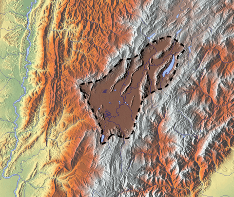
The Tilatá Formation is found at its type locality in the synclinal of the Sisga Reservoir in Chocontá, in the Bogotá River valley,[6] and along the road from Bogotá to Tunja.[1]
See also
References
Bibliography
- Guerrero Uscátegui, Alberto Lobo. 1992. Geología e Hidrogeología de Santafé de Bogotá y su Sabana, 1–20. Sociedad Colombiana de Ingenieros.
- Molnar, Peter. 2004. Late Cenozoic increase in accumulation rates of terrestrial sediment. Annual Review of Earth and Planetary Sciences 32. 67-89.
- Monsalve, Maria Luisa; Nadia R. Rojas; Francisco A. Velandia P.; Iraida Pintor, and Lina Fernanda Martínez. 2011. Caracterización geológica del cuerpo volcánico de Iza, Boyacá - Colombia. Boletín de Geología 33. 117-130. Accessed 2017-02-25.
- Montoya Arenas, Diana María, and Germán Alfonso Reyes Torres. 2005. Geología de la Sabana de Bogotá, 1–104. INGEOMINAS.
Maps
- Renzoni, Giancarlo, and Humberto Rosas. 2009. Plancha 171 - Duitama - 1:100,000, 1. INGEOMINAS. Accessed 2017-06-06.
- Renzoni, Giancarlo; Humberto Rosas, and Fernando Etayo Serna. 1998. Plancha 191 - Tunja - 1:100,000, 1. INGEOMINAS. Accessed 2017-06-06.
- Montoya, Diana María, and Germán Reyes. 2009. Plancha 209 - Zipaquirá - 1:100,000, 1. INGEOMINAS. Accessed 2017-06-06.
- Ulloa, Carlos E; Erasmo Rodríguez, and Jorge E. Acosta. 1998. Plancha 227 - La Mesa - 1:100,000, 1. INGEOMINAS. Accessed 2017-06-06.
- Buitrago, José Alberto; Roberto Terraza M., and Fernando Etayo. 1998. Plancha 228 - Santafé de Bogotá Noreste - 1:100,000, 1. INGEOMINAS. Accessed 2017-06-06.
- Acosta, Jorge E., and Carlos E. Ulloa. 1998. Plancha 246 - Fusagasugá - 1:100,000, 1. INGEOMINAS. Accessed 2017-06-06.
External links
- Gómez, J.; N.E. Montes; Á. Nivia, and H. Diederix. 2015. Plancha 5-09 del Atlas Geológico de Colombia 2015 – escala 1:500,000, 1. Servicio Geológico Colombiano. Accessed 2017-03-16.