Subachoque Formation
| Subachoque Formation Stratigraphic range: Early to Mid Pleistocene ~2.5–1 Ma | |
|---|---|
| Type | Geological formation |
| Underlies | Sabana Formation |
| Overlies |
Tilatá Formation Guadalupe Gp. Guaduas Fm., Cacho Fm., Bogotá Fm., Regadera Fm. |
| Thickness | up to 150 metres (490 ft) |
| Lithology | |
| Primary | Shale, lignite |
| Other | Sandstone |
| Location | |
| Coordinates | 4°57′17.3″N 74°13′07.5″W / 4.954806°N 74.218750°WCoordinates: 4°57′17.3″N 74°13′07.5″W / 4.954806°N 74.218750°W |
| Region |
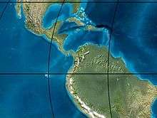
Bogotá savanna, Altiplano Cundiboyacense Eastern Ranges, Andes |
| Country |
|
| Type section | |
| Named for | Subachoque |
| Named by | Helmens & Hammen |
| Location | Subachoque Synclinal |
| Year defined | 1995 |
| Coordinates | 4°57′17.3″N 74°13′07.5″W / 4.954806°N 74.218750°W |
| Region | Cundinamarca |
| Country |
|
 Paleogeography of the Pleistocene by Ron Blakey | |
The Subachoque Formation (Spanish: Formación Subachoque, Q1su) is a geological formation of the Bogotá savanna, Altiplano Cundiboyacense, Eastern Ranges of the Colombian Andes. The formation consists mainly of sandy shales and lignite with sandstone beds. The Subachoque Formation dates to the Quaternary period; Early to Middle Pleistocene epoch (from approximately 2.5 to 1 Ma), and has a maximum thickness of 150 metres (490 ft). It is the lowermost formation of the lacustrine and fluvio-glacial sediments of Lake Humboldt.
Etymology
The formation was first defined and named by Helmens and Van der Hammen in 1995 after Subachoque, Cundinamarca.[1]
Description
Lithologies
The Subachoque Formation consists mainly of sandy shales, some organic, with lignite and sandstone beds.[1]
Stratigraphy and depositional environment
The Subachoque Formation is the lowermost of the lagunal and alluvial sequence of the Bogotá savanna. In parts, it conformably overlies the Tilatá Formation and other parts unconformably the Cretaceous Guadalupe Group and the Paleogene Guaduas, Cacho, Bogotá, and Regadera Formations. The Subachoque Formation is overlain by other Quaternary deposits of Lake Humboldt. The age has been estimated to be Early to Middle Pleistocene based on fission track analysis, with reported ages between 2.5 and 1 Ma.[2] The depositional environment has been interpreted as lacustrine and fluvio-glacial with alluvial fans.[1]
Outcrops
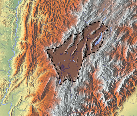
The Subachoque Formation is found at its type locality in the western flank of the synclinal of Subachoque and in the western flank of the synclinal of Guasca.[1] The deposition of the Subachoque Formation postdates the main reverse movement of the Bogotá Fault.[3]
See also
References
Bibliography
- Montoya Arenas, Diana María, and Germán Alfonso Reyes Torres. 2005. Geología de la Sabana de Bogotá, 1–104. INGEOMINAS.
Maps
- Buitrago, José Alberto; Roberto Terraza M., and Fernando Etayo. 1998. Plancha 228 - Santafé de Bogotá Noreste - 1:100,000, 1. INGEOMINAS. Accessed 2017-06-06.
- Various, Authors. 1997. Mapa geológico de Santa Fe de Bogotá – Geological Map Bogotá – 1:50,000, 1. INGEOMINAS. Accessed 2017-03-16.
Further reading
- Guerrero Uscátegui, Alberto Lobo. 1992. Geología e Hidrogeología de Santafé de Bogotá y su Sabana, 1–20. Sociedad Colombiana de Ingenieros.
External links
- Gómez, J.; N.E. Montes; Á. Nivia, and H. Diederix. 2015. Plancha 5-09 del Atlas Geológico de Colombia 2015 – escala 1:500,000, 1. Servicio Geológico Colombiano. Accessed 2017-03-16.