Tes Nez Iah, Arizona
| Tes Nez Iah, Arizona | |
|---|---|
| Populated place | |
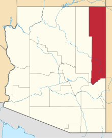
 Tes Nez Iah Location within the state of Arizona  Tes Nez Iah Tes Nez Iah (the US) | |
| Coordinates: 36°56′35″N 109°42′32″W / 36.94306°N 109.70889°WCoordinates: 36°56′35″N 109°42′32″W / 36.94306°N 109.70889°W | |
| Country | United States |
| State | Arizona |
| County | Apache |
| Elevation[1] | 4,751 ft (1,448 m) |
| Time zone | UTC-7 (Mountain (MST)) |
| • Summer (DST) | UTC-7 (MST) |
| Area code(s) | 928 |
| FIPS code | 04-73280 |
| GNIS feature ID | 24651 |
Tes Nez Iah is a populated place situated in the far north of Apache County, Arizona, just south of the Colorado border.[2] It is along the banks of the Chinle Wash, approximately four miles west of Mexican Water.[3] It has an estimated elevation of 4,751 feet (1,448 m) above sea level.[1] The name is derived from the Navajo t'iis nééz íí'á, meaning "tall cottonwood trees".[4]
References
- 1 2 "Feature Detail Report for: Tes Nez Iah". Geographic Names Information System. United States Geological Survey.
- ↑ "Tes Nez Iah (in Apache County, AZ) Populated Place Profile". AZ Hometown Locator. Retrieved May 27, 2017.
- ↑ Roberts, David (2006). Sandstone Spine: Seeking the Anasazi on the First Traverse of the Comb Ridge. Seattle, Washington: The Mountaineers Books. p. 79. ISBN 1594852383.
- ↑ Bright, William (2013). Native American Placenames of the Southwest: A Handbook for Travelers. Norman, Oklahoma: University of Oklahoma Press. p. 490. ISBN 0806189142.
This article is issued from
Wikipedia.
The text is licensed under Creative Commons - Attribution - Sharealike.
Additional terms may apply for the media files.