Oak Springs, Arizona
| Oak Springs, Arizona | |
|---|---|
| Census-designated place | |
 Oak Springs | |
| Coordinates: 35°28′32″N 109°07′39″W / 35.47556°N 109.12750°WCoordinates: 35°28′32″N 109°07′39″W / 35.47556°N 109.12750°W | |
| Country | United States |
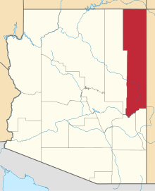
| State | Arizona |
| County | Apache |
| Area[1] | |
| • Total | 0.19 sq mi (0.48 km2) |
| • Land | 0.19 sq mi (0.48 km2) |
| • Water | 0.00 sq mi (0.00 km2) |
| Elevation | 6,542 ft (1,994 m) |
| Population (2010) | |
| • Total | 63 |
| • Estimate (2016)[2] | N/A |
| Time zone | UTC-7 (MST) |
| • Summer (DST) | UTC-6 (MDT) |
| FIPS code | 04-50480 |
| GNIS feature ID | 0025269 |
Oak Springs is a census-designated place (CDP) in Apache County, Arizona, United States. The population was 63 at the 2010 census.[3]
Geography
Oak Springs is located at 35°28′32″N 109°07′39″W / 35.47556°N 109.12750°W[4] along Indian Route 12, about 10 miles (16 km) north of Interstate 40 and 13 miles (21 km) south of St. Michaels.
According to the United States Census Bureau, the CDP has a total area of 0.19 square miles (0.48 km2), all land.[3]
Demographics
| Historical population | |||
|---|---|---|---|
| Census | Pop. | %± | |
| U.S. Decennial Census[5] | |||
References
- ↑ "2016 U.S. Gazetteer Files". United States Census Bureau. Retrieved Jul 18, 2017.
- ↑ "Population and Housing Unit Estimates". Retrieved June 9, 2017.
- 1 2 "Geographic Identifiers: 2010 Demographic Profile Data (G001): Oak Springs CDP, Arizona". U.S. Census Bureau, American Factfinder. Retrieved April 18, 2013.
- ↑ "US Gazetteer files: 2010, 2000, and 1990". United States Census Bureau. 2011-02-12. Retrieved 2011-04-23.
- ↑ "Census of Population and Housing". Census.gov. Retrieved June 4, 2016.
This article is issued from
Wikipedia.
The text is licensed under Creative Commons - Attribution - Sharealike.
Additional terms may apply for the media files.