Nahata Dziil, Arizona
| Nahata Dziil, Arizona | |
|---|---|
| Chapter | |
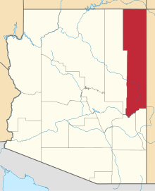
 Nahata Dziil Location within the state of Arizona  Nahata Dziil Nahata Dziil (the US) | |
| Coordinates: 35°04′36″N 109°19′40″W / 35.07667°N 109.32778°WCoordinates: 35°04′36″N 109°19′40″W / 35.07667°N 109.32778°W | |
| Country | United States |
| State | Arizona |
| County | Apache |
| Elevation[1] | 6,030 ft (1,838 m) |
| Time zone | UTC-7 (Mountain (MST)) |
| • Summer (DST) | UTC-7 (MST) |
| Area code(s) | 928 |
| FIPS code | 04-TS502 |
| GNIS feature ID | 2419027 |
Nahata Dziil, sometimes written Nahatadzill is a Chapter situated in Apache County, Arizona. It is one of the Chapters which make up the Fort Defiance Agency, one of five agencies which make up the Navajo Nation. As of the 2010 census, the Chapter had a total population of 1731, of which 1572 were Navajo.[2] In 1991, it became the 110th and final Chapter of the Navajo Nation.[3] It has an estimated elevation of 6,030 feet (1,840 m) above sea level.[1]
References
- 1 2 "Feature Detail Report for: Nahata Dziil". Geographic Names Information System. United States Geological Survey.
- ↑ Navajo Population Profile. U.S. Census Bureau. December 2013. p. 33.
- ↑ "Nahata Dziil Chapter celebrates groundbreaking of much needed shopping center". The Navajo Nation Council. September 5, 2008. Archived from the original (PDF) on December 30, 2016. Retrieved December 30, 2016.
This article is issued from
Wikipedia.
The text is licensed under Creative Commons - Attribution - Sharealike.
Additional terms may apply for the media files.