Horse Mesa, Apache County, Arizona
| Horse Mesa, Arizona | |
|---|---|
| Populated place | |
 Horse Mesa Location within the state of Arizona  Horse Mesa Horse Mesa (the US) | |
| Coordinates: 36°42′18″N 109°02′47″W / 36.70500°N 109.04639°WCoordinates: 36°42′18″N 109°02′47″W / 36.70500°N 109.04639°W | |
| Country | United States |
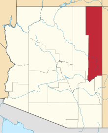
| State | Arizona |
| County | Apache |
| Elevation[1] | 5,653 ft (1,723 m) |
| Time zone | UTC-7 (Mountain (MST)) |
| • Summer (DST) | UTC-7 (MST) |
| Area code(s) | 928 |
| FIPS code | 04-33665 |
| GNIS feature ID | 25265 |
Horse Mesa is a populated place situated along the border with New Mexico in Apache County, Arizona.[2] It is one of two populated places in the state with this name, the other being situated in Maricopa County. It has an estimated elevation of 5,653 feet (1,723 m) above sea level.[1]
References
- 1 2 "Feature Detail Report for: Horse Mesa". Geographic Names Information System. United States Geological Survey.
- ↑ "Horse Mesa (in Apache County, AZ) Populated Place Profile". AZ Hometown Locator. Retrieved November 27, 2016.
This article is issued from
Wikipedia.
The text is licensed under Creative Commons - Attribution - Sharealike.
Additional terms may apply for the media files.