Tanner Springs, Arizona
| Tanner Springs, Arizona | |
|---|---|
| Populated place | |
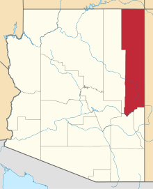
 Tanner Springs Location within the state of Arizona  Tanner Springs Tanner Springs (the US) | |
| Coordinates: 35°17′18″N 109°41′08″W / 35.28833°N 109.68556°WCoordinates: 35°17′18″N 109°41′08″W / 35.28833°N 109.68556°W | |
| Country | United States |
| State | Arizona |
| County | Apache |
| Elevation[1] | 5,787 ft (1,764 m) |
| Time zone | UTC-7 (Mountain (MST)) |
| • Summer (DST) | UTC-7 (MST) |
| Area code(s) | 928 |
| FIPS code | 04-71910 |
| GNIS feature ID | 24640 |
Tanner Springs, historically also known as La Xara Springs and Ojo La Xara, is a populated place situated in Apache County, Arizona.[2] The location began as a trading post, which was opened by Seth Tanner, from where its name is derived It has an estimated elevation of 5,787 feet (1,764 m) above sea level.[1]
References
- 1 2 "Feature Detail Report for: Tanner Springs". Geographic Names Information System. United States Geological Survey.
- ↑ "Tanner Springs (in Apache County, AZ) Populated Place Profile". AZ Hometown Locator. Retrieved May 23, 2017.
This article is issued from
Wikipedia.
The text is licensed under Creative Commons - Attribution - Sharealike.
Additional terms may apply for the media files.