Tattenhall
| Tattenhall | |
|---|---|
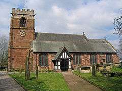 St Alban's Church | |
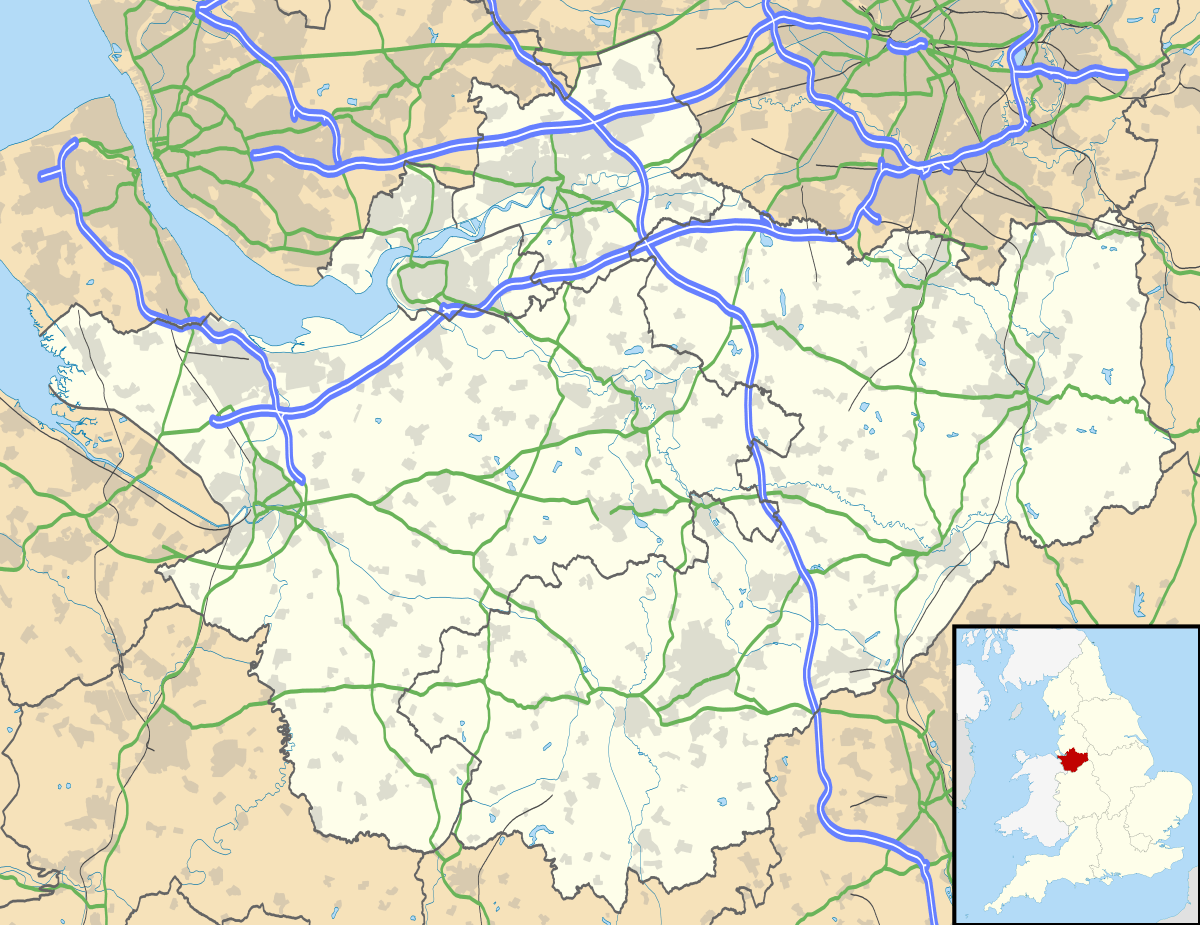 Tattenhall Tattenhall shown within Cheshire | |
| Population | 2,079 (2011) |
| OS grid reference | SJ486585 |
| Civil parish |
|
| Unitary authority | |
| Ceremonial county | |
| Region | |
| Country | England |
| Sovereign state | United Kingdom |
| Post town | CHESTER |
| Postcode district | CH3 |
| Dialling code | 01829 |
| Police | Cheshire |
| Fire | Cheshire |
| Ambulance | North West |
| EU Parliament | North West England |
| UK Parliament | |
Tattenhall is a village and former civil parish, now in the parish of Tattenhall and District, 8 miles south-east of Chester, in the unitary authority of Cheshire West and Chester and the ceremonial county of Cheshire, England. At the 2001 Census, the population was recorded as 1,986,[1] increasing to 2,079 at the 2011 Census.[2] The civil parish was abolished in 2015 to form Tattenhall and District.[3]
History
The settlement of Tatenale was recorded in the Domesday Book of 1086. The name is believed to be derived from the Old English personal name Tata and halh, meaning "a meadow". The spelling of the village has altered over the centuries: Tatenhala (1280), Tattenhall (1289), Tatnall (1473), Tottenhall (1553) and Tettenhall (1649).[4]
The village was a self-sustained settlement in the 15th and 16th Centuries.[5] The building of the Chester Canal (now part of the Shropshire Union Canal) provided an economic boost to the village, improving transportation and allowing local produce to be exported. Tattenhall Road railway station opened in 1840 and linked Tattenhall to Chester and Crewe. Tattenhall railway station opened in 1872,[6] linking the village with Whitchurch. The railways led to the establishment of industries including the manufacture of glue, gelatine, fertiliser and bricks.
Tattenhall railway station closed in 1957,[7] as did the Whitchurch and Tattenhall Railway between Chester and Whitchurch. Tattenhall Road railway station closed in 1966.[8] New housing developments saw the village expand through the second half of the 20th Century.[5]
Community

St Alban's Church is designated by English Heritage as a Grade II* listed building. Parts of the building are thought to date from the early 16th Century. Its benefice is combined with that of All Saints, Handley.[9] St Plegmund's Roman Catholic church in the village closed in 2012. Its 1970s building was demolished in 2014.[10]
Tattenhall Park Primary School is a coeducational community primary school, teaching pupils aged 3-11. Older pupils travel to schools in Malpas and Tarporley for state-provided secondary education.
Agriculture remains an important element of the local economy. A number of buildings in the centre of the village are now used as offices.[11] Tourism is also important to the village. The Ice Cream Farm, owned by Cheshire Farm Ice Cream, is to the north of the village in nearby Newton-by-Tattenhall. It attracts over 500,000 visitors a year.[12] The 300 berth Tattenhall Marina on the Shropshire Union Canal opened in 2009.
The centre of the village has a number of shops including a post office and butcher. There are three pubs in Tattenhall - The Sportmans, The Letters Inn and The Bear & Ragged Staff.
Tattenhall is home to a group of houses designed in 1927 by architect Clough Williams-Ellis, famous for creating the Italianate village of Portmeirion in north west Wales.
Governance
An electoral ward of the same name exists. This ward stretches east to Tilstone Fearnall with a total population taken at the 2011 census of 4,374.[13]
Notable residents
- Leslie Jones (1891-1962), cricketer
- Tommy Scott - frontman/songwriter of Liverpool band Space, moved to Tattenhall in 2008.
- Ben Woodburn - Professional footballer for Liverpool FC
- Herbert Watkins-Pitchford (1868-1951) pioneer veterinarian working in South Africa, born and raised in Tattenhall
- John Pearson (1771 - 1841) Advocate General in Bengal
See also
References
- ↑ "2001 Census: Tattenhall CP". Office for National Statistics. Retrieved 19 September 2008.
- ↑ "Parish population 2011". Retrieved 30 May 2015.
- ↑ "TATTENHALL". GENUKI. Retrieved 15 April 2018.
- ↑ "Village History". Tattenhall & District Parish Council. Archived from the original on 25 June 2008. Retrieved 19 September 2008.
- 1 2 "Village History". Tattenhall & District Parish Council. Archived from the original on 25 June 2008. Retrieved 12 June 2017.
- ↑ "Tattenhall Railway Station". Disused Stations. Retrieved 12 June 2017.
- ↑ Oppitz, Leslie (1997). Cheshire Railways Remembered. Countryside Books. p. 147. ISBN 1-85306-458-0.
- ↑ Oppitz, Leslie (1997). Cheshire Railways Remembered. Countryside Books. pp. 33, 147–148. ISBN 1-85306-458-0.
- ↑ Tattenhall, St Alban, Church of England, retrieved 15 October 2009
- ↑ "St Plegmund's Roman Catholic Church". Tattenhall & District Local History. Retrieved 12 June 2017.
- ↑ "Village History". Tattenhall & District Parish Council. Retrieved 12 June 2017.
- ↑ "Ice Cream Farm - About Us". Cheshire Farm Ice Cream. Archived from the original on 22 November 2009. Retrieved 5 November 2009.
- ↑ "Ward population 2011". Retrieved 30 May 2015.
External links
| Wikimedia Commons has media related to Tattenhall. |
| Wikivoyage has a travel guide for Tattenhall. |
- Tattenhall village website
- Tattenhall village website in photos
- Area map of Tattenhall and District civil parish
- Area map of Tattenhall ward
Cheshire Portal | |
| Unitary authorities | |
| Major settlements | |
| Rivers | |
| Topics | |