Tasnin
| Tasnin تسنين Tesnin[1] | |
|---|---|
| Village | |
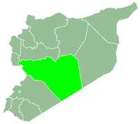
 Tasnin Location in Syria | |
| Coordinates: 34°52′10″N 36°39′29″E / 34.86944°N 36.65806°ECoordinates: 34°52′10″N 36°39′29″E / 34.86944°N 36.65806°E | |
| Country |
|
| Governorate | Homs |
| District | Rastan |
| Subdistrict | Rastan |
| Population (2004) | |
| • Total | 2,713 |
| Time zone | UTC+3 (EET) |
| • Summer (DST) | UTC+2 (EEST) |
Tasnin (Turkish: Tesnin,[1] Arabic: تسنين, translit. Tāsnīn, also spelled Tasneen) is a village in northern Syria, administratively part of the Homs Governorate, located 32 kilometers northwest of Homs in between the cities of al-Rastan and Talbiseh.[2] Other nearby localities include Kafr Nan and Kissin to the northwest, Gharnatah to the northeast and Akrad Dayasinah to the southwest.
According to the Syria Central Bureau of Statistics (CBS), Tasnin had a population of 2,713 in the 2004 census.[3] Its inhabitants are predominantly Turkmen Sunni Muslims, with a small community of Alawites.[2] Tasnin's inhabitants mostly work in agriculture and husbandry. The village has three schools and a mosque.[2]
References
- 1 2 Günümüzde Suriye Türkmenleri. — Suriye’de Değişimin Ortaya Çıkardığı Toplum: Suriye Türkmenleri, p. 14 ORSAM Rapor № 83. ORSAM – Ortadoğu Türkmenleri Programı Rapor № 14. Ankara — November 2011, 33 pages.
- 1 2 3 "مجزرة تسنين – ريف حمص الشمالي / التطهير الطائفي -د. خولة الحديد". Al-Ayyam (in Arabic). 2014-03-03. Archived from the original on 2015-10-07.
- ↑ General Census of Population and Housing 2004 Archived 2013-01-12 at Archive.is. Syria Central Bureau of Statistics (CBS). Homs Governorate. (in Arabic)
|  | |||||||||||||||||||||||||||||
|
| ||||||||||||||||||||||||||||||
| ||||||||||||||||||||||||||||||
| ||||||||||||||||||||||||||||||
| ||||||||||||||||||||||||||||||
This article is issued from
Wikipedia.
The text is licensed under Creative Commons - Attribution - Sharealike.
Additional terms may apply for the media files.