Gharnatah
| Gharnatah غرناطة al-Ghajar[1] ( الغجر ) | |
|---|---|
| Village | |
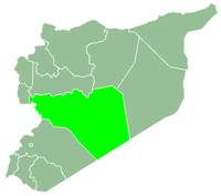
 Gharnatah Location in Syria | |
| Coordinates: 34°53′45″N 36°41′4″E / 34.89583°N 36.68444°ECoordinates: 34°53′45″N 36°41′4″E / 34.89583°N 36.68444°E | |
| Country |
|
| Governorate | Homs |
| District | Rastan |
| Subdistrict | Rastan |
| Population (2004) | |
| • Total | 5,366 |
| Time zone | UTC+3 (EET) |
| • Summer (DST) | UTC+2 (EEST) |
Al-Ghajar (Turkish: El-Kacer,[1] Arabic: الغجر, translit. Al-Ghārjar) or Gharnatah (Turkish: El-Gırnata,[1] Arabic: غرناطة, translit. al-Gharnātah, also known as Ghajar Amir) is a village in northern Syria, administratively part of the Rastan District, located north of Homs. According to the Syria Central Bureau of Statistics (CBS), Gharnatah had a population of 5,366 in the 2004 census.[2] Its inhabitants are predominantly Sunni Muslims of Turkmen descent.[3][4]
References
- 1 2 3 Günümüzde Suriye Türkmenleri. — Suriye’de Değişimin Ortaya Çıkardığı Toplum: Suriye Türkmenleri, p. 15 ORSAM Rapor № 83. ORSAM – Ortadoğu Türkmenleri Programı Rapor № 14. Ankara — November 2011, 33 pages.
- ↑ General Census of Population and Housing 2004. Syria Central Bureau of Statistics (CBS). Homs Governorate. (in Arabic)
- ↑ Khalifa, Mustafa (October 2013). "The Impossible Partition of Syria" (PDF). Arab Reform Initiative. p. 4. Archived from the original (PDF) on November 16, 2013.
- ↑ "مجزرة تسنين – ريف حمص الشمالي / التطهير الطائفي -د. خولة الحديد". Al-Ayyam (in Arabic). 2014-03-03.
|  | |||||||||||||||||||||||||||||
|
| ||||||||||||||||||||||||||||||
| ||||||||||||||||||||||||||||||
| ||||||||||||||||||||||||||||||
| ||||||||||||||||||||||||||||||
This article is issued from
Wikipedia.
The text is licensed under Creative Commons - Attribution - Sharealike.
Additional terms may apply for the media files.